july 2 2008 : cluculz lake, b.c., canada
Of course three days after giving up on Vancouver Island our readers that live there or in Vancouver write to tell us they’d love to take us out. Problem being that we’ve kept truckin’ on already. Truth is we’ve been itching to move again, and just weren’t ready for relaxing on an island. We feel like putting miles under our wheels.
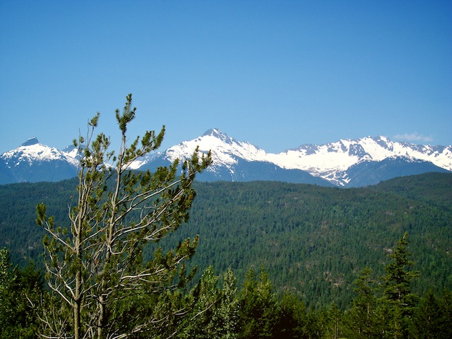
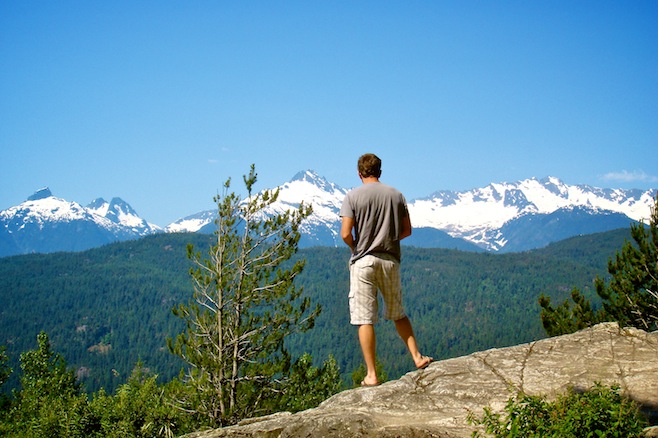
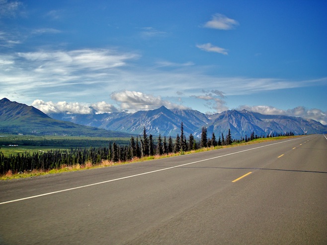
There is a stretch of highway north of Vancouver for about 150 miles that is some of the best we’ve ever seen. Mountains, glaciers, pine forests, lakes, and rivers, completely surrounded us at all times along here. To make it all even better was the eighty degree weather, and the sunny blue skies.
Today the drive wound away from the mountains and turned into big rolling hills of green forests and farmland. Still beautiful, just not in the majestic way of the day before. We did however see a deer standing in a creek up to his belly just staring at the water. We’ve seen a lot of deer but that was pretty different.
Tonight we were stopped in a long line of traffic for some road construction. We noticed a sign for a campground as we were sitting there and decided to call in for the night. When we pulled in we saw a sign on the office door stating the campground was closed until further notice. We decided to have a look anyway. Down along the edge of the lake we found a great little campground that looked as if everybody had just left the day before. Despite it being deserted we decided to spend the night. Now we’re just sitting here all alone enjoying a bonfire and wondering why the heck the place is closed.
july 3 2008 : seeley lake, b.c., canada
I think we now know why the campground is closed. It’s the bugs. At ten o’clock last night we went to bed. At midnight we were still killing mosquitoes. Despite the eighty-five degree temperature in the bus the only way to sleep was to pull a blanket over our entire body. By three o’clock we’d each managed about an hour of sleep. By five we had two hours. And by five thirty I was outside covered in bug spray, still getting eaten alive, and writing this update. That was absolutely miserable and I am in no way looking forward to today.
Hitting the road for our earliest start ever neither one of us was feeling too great. Ali had even had to skip the coffee ritual due to the massive amounts of mosquitoes. It was therefore very nice to be driving down the road and quickly see two big moose wading across a pond. Not two minutes further on was a black bear making his way across a grassy field. Next up were the ubiquitous deer. We were on a roll and our very tired spirits were lifted.
We stopped for gas and Ali went in to buy a coffee. She got to talking with the cashier and told her that we had just seen moose and a bear. The cashier just shrugged. I suppose it isn’t all that exciting after the first few hundred times you see them.
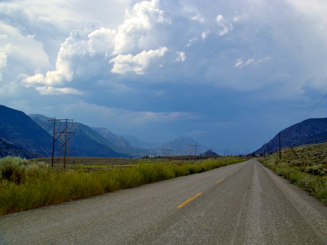
Tonight we are settled in all by ourselves yet again at a little Provincial Park campground along a lake. Just across the lake from us a couple of mountains rise straight up, with snow still clinging to their tops. A woodpecker is playing music on a metal sign nearby, and two loons are swimming just below us in the water. Despite the fact that the loon is the Minnesota state bird neither one of us has ever been so close to one of them before. It really is nice way the hell up here in Canada.
july 5 2008 : dease lake, b.c., canada
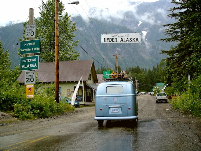
The beauty only increased along the roads the last couple of days despite quite a bit of rain. Yesterday we came to a fork in the road. One way pointed to Hyder, Alaska forty miles away. Neither of us had ever heard of Hyder, or had any idea that we were anywhere near an Alaskan entry point. It sounded like a fun side trip so we turned that way.
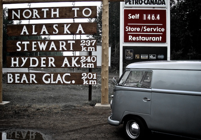
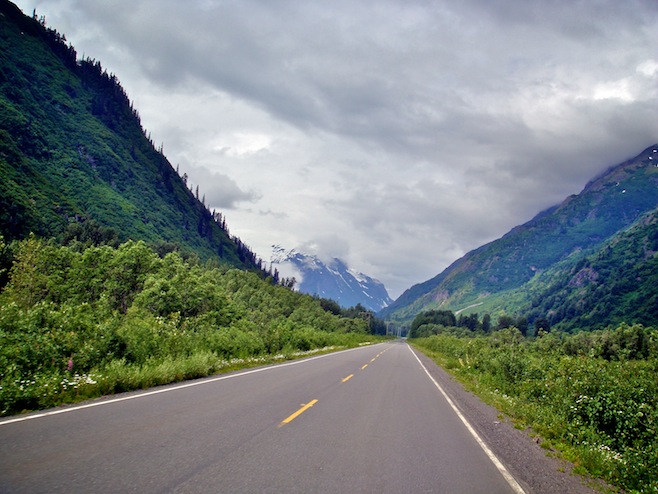
Immediately the road dived into snowy mountains. At only 1300 feet there was snow along the road. In July for crying out loud. What must this place be like in January? Along the way we passed Bear Glacier, the setting for the movie Insomnia, which the nearby towns would make sure you knew. When we came to Hyder there was no U.S. Customs checkpoint. There really would be no point since there is no getting out of Hyder from the U.S., you would need to cross the border again to go anywhere.
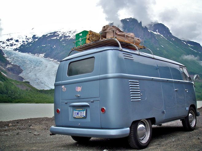
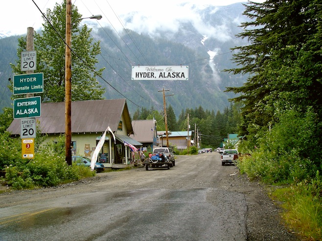
Hyder was a cute little town, consisting of one dirt road about two blocks long. There was a bar, an abandoned gas station, and a general store. That was about it. Along the road though were a couple of makeshift tents selling hot dogs and hamburgers, with locals milling about each of them. Ali and I wondered what was going on. It seemed awfully busy for such a small place. We parked and got out.
While Ali was digging around in the back of the bus I watched as a lady walked past in an outfit made up of nothing but flags. Ever so slowly there was a light bulb going on in my head. Then I noticed the entire street was lined with red, white, and blue banners. The lightbulb was getting brighter. Finally, it came to me. “Ali, we’re idiots. It’s the fourth of July!” We are so clueless when it comes to dates, holidays, weekends, whatever. If it is related to time we won’t realize it when we’re traveling.
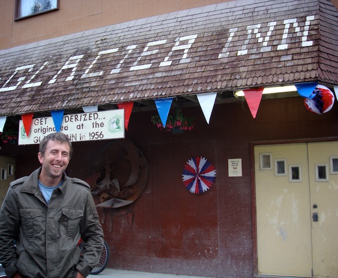
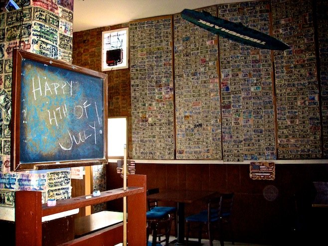
We ducked into the Glacier Inn for some liquid holiday refreshments. Inside we found the walls covered in cash. Signed bills covered everything. They had even started a second layer of walls by putting plywood sheets on hinges. We got to talking to the owner who told us that people had been putting the bills on the walls since they opened in 1956. She said there was now over $75,000 up there. She told us there’d be all sorts of good ol’ small town fun later in the day and said we should come back. She even said that we could camp right in the abandoned gas station parking lot. She owned that too.
Turns out that Hyder is famous for bears. There is a salmon stream that, about three weeks from now, would be full of black and grizzly bears gorging themselves. We took the dirt road out of town and went and checked it out. Sure enough, there wasn’t a salmon to be seen yet. The park service has a really nice viewing deck built right above the stream that would be an amazing perch to watch the bears from, but we were just too early.
We continued up the road towards Salmon Glacier. It was about twenty miles, the last few of which were amazing. The road climbed right up a mountainside directly over this huge retreating glacier. The views and the layers of mountains seemed to go on forever.
Back in town a few hours later we were just in time for the Bushwoman contest. The women competed on a course that had them chopping logs, washing socks, shooting bears, flipping flapjacks, and putting on lipstick while running. The winner was crowned Bushwoman of the year, and indeed she looked the part, rather rugged and large. However, being such a small town, we later found out that this same burly bushwoman finished second in the wet t-shirt contest held earlier in the day. Sadly we missed that. If she was second I’d hate to see third.
Shortly after that was the parade. Yes, it was two blocks long, and yes, it contained a bunch of fire trucks from the Canadian town across the border, but it was a parade, it was Independence day, and the kids got a bunch of candy.
After that everybody dispersed, only to reappear in the bar over the next hour or so. Only now everybody in town had changed into a sports themed costume. Nothing says Independence Day like a good costume party. Despite our non-sporting clothing we had a good time, and even got to participate in the beer can and tennis ball bowling competition. Ali bowled a five, which was exactly five more than I got, and four less than the winner.
Today we hit the road with a lot of rain. It never really stopped all day, just slowed down a few times. We were on the Cassiar Highway, which whenever we could get a peek through the clouds, looked to be pretty stunning. The sheer number of white capped mountains around us just amazed me. There wasn’t a time today that I looked in my mirror and didn’t see a picturesque mountain scene.
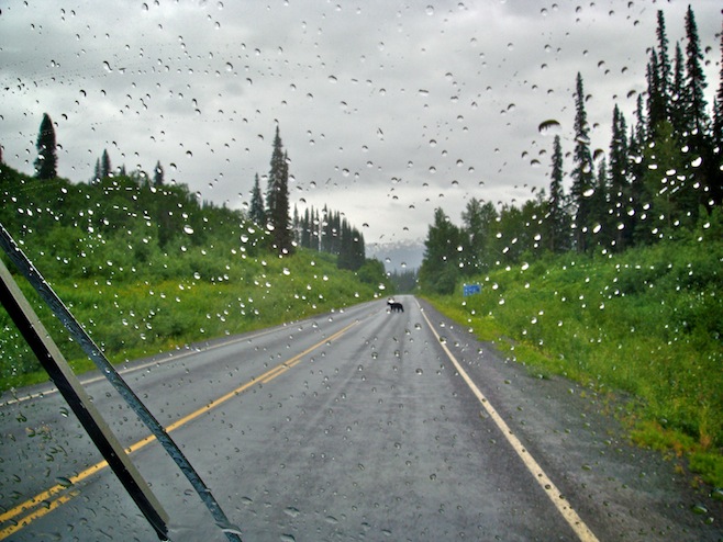
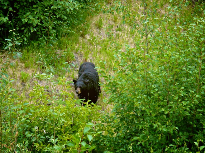
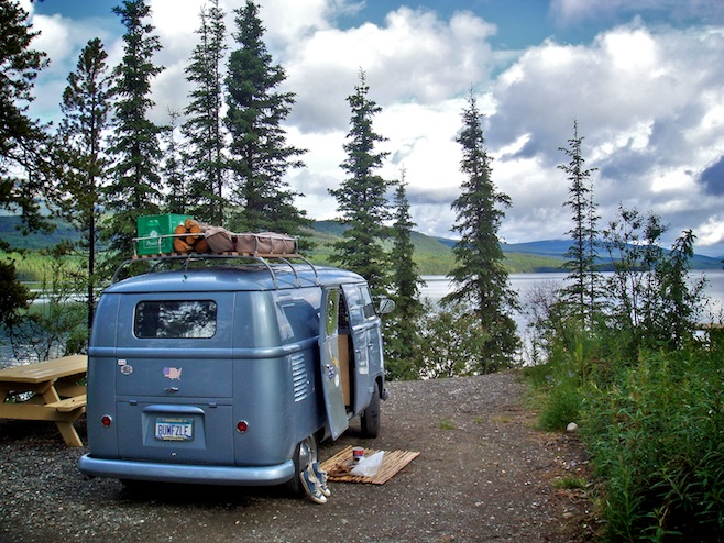
Though we had a tough time getting to see the scenery we did get to see plenty of bears. During one stretch they seemed to be everywhere. The first one heard us coming and lifted his head out of the tall grass. His face was perfectly round with just two little circles for ears sticking up. He looked like a teddy bear. Then he stood up for a closer look, decided he didn’t like us, and turned into the bush. We saw a few more like this in the ditches or crossing the roads, but none seemed to want to let us get too near. But then we came around a corner and found one just off to the side of the road eating grasses, totally unconcerned with having us pull over right alongside of him. We got to watch him for a few minutes, eating, scratching the ground, and wiping his face on the weeds, possibly in an effort to get rid of the mass of mosquitoes that were on his fur. He eventually made his way into the forest and we continued on. We made it to Dease Lake and pulled into a camp perched on the edge of yet another mountain ringed lake.
july 6 2008 : watson lake, yukon, canada
We left B.C. behind and entered Yukon today. Or is it the Yukon? Either way it was a tough day for the bus. I don’t know what the deal was, but we got absolutely pummeled by flying gravel on this northern stretch of the Cassiar Highway. Obviously the biggest reason was that the road was quite often gravel, but we’ve driven gravel roads plenty of times and not had this sort of bus mangling.
First up was a direct hit to the middle of the driver side safari window. A chip smack dab in the middle of it. Not off to the side where it wouldn’t matter, but instead it is just one inch below where I naturally stare straight ahead at the road. I could feel myself going cross-eyed within the hour.
Next up was a blast from a two inch rock that sounded like we’d been shot and elicited a nice scream from the passenger seat. This one hit about six inches below the window next to the VW emblem and left a nice dent and a whole lot of missing paint. We rounded out the day of destruction with another small chip on Ali’s windshield. The flat front of these buses sure do not lend themselves to glancing blows. It sometimes feels like we are just a rolling target for road debris.
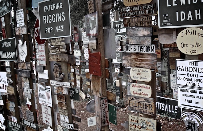
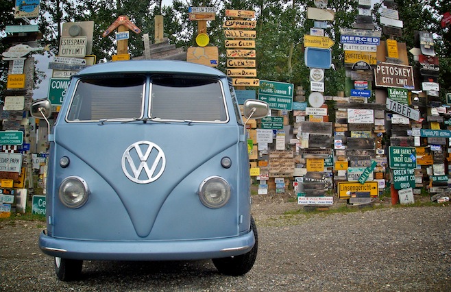
In Watson Lake today we visited the Signpost Forest. Legend has it that a homesick G.I. tacked up a road sign from his hometown here. Since then some 65,000 signs have been nailed up by travelers passing through. Despite knowing about this place ahead of time Ali and I still arrived completely unprepared, with absolutely nothing to make a proper sign out of. No flat surfaces to use as our canvas, and no paint. We left the forest bumfuzzle-less.
We’ve spent quite a bit of time in Canada in the past year, and I have to say that aside from Saskatchewan, it really is a wonderful place to visit. But man we sure wouldn’t want to live here. Honestly I don’t know how anybody affords this place. When traveling we’ve got three main expenses: gas, food, and lodging.
Now the six dollar a gallon gas I really don’t have a problem with. I never complain about the price of gas because it’s my opinion that it should have been this high ages ago. If it had been then maybe by now we’d have some better options.
But what is the deal with food here? Admittedly our diet consists of fast food and snack foods, and maybe carrots and brussel sprouts are different, but our food is through the roof. Macca’s prices are 69% higher here than the States. I know this because their Dollar Menu is actually a $1.69 Value Menu. And ma and pa diners are no better. We can’t get out of a typical family diner type restaurant for under thirty bucks these days. A meal that should cost maybe $14. But hey, the food situation is easily solved by simply eating less. The real problem is beer. A case of Labatts cost $44. This is the equivalent of a case of Bud for goodness sake. And please, don’t even think about ordering a beer at a restaurant.
Lodging. Oh who cares? Beer is two bucks a can, things couldn’t get any worse. So they’ve got cheap medicine. Whoopee, I haven’t been to a doctor in ten, maybe fifteen years.
Lucky for them the millions of acres of unmolested forests, the thousands upon thousands of glacier fed lakes, and the gazillion or so bears running around the place make up for it all.
july 8 2008 : outside dawson city, yukon, canada
The past couple of days have simply been road tripping days. Yesterday was our first real day on the Alaskan Highway. To be honest we much preferred the other highways, which were much less trafficked and full of wildlife. The Alaskan Highway is only one lane in each direction, but realistically you could fit two or three, and the forest has been cut back at least fifty yards from the road the entire way. You could land a 747 on this road. It just had the feel that there was no chance of seeing an animal anywhere near it, and we didn’t.
The scenery was still top notch though. There certainly is no shortage of mountains up here. The other thing that has really struck me are the amount of lakes, all without any sign of man on them. I read somewhere the other day that Alaska has over three million lakes larger than 20 acres. That number just blows me away. If that’s true than I am almost embarrassed by our Minnesota license plate proclaiming us the Land of 10,000 Lakes.
We stayed in Whitehorse for the night, which was really nothing too special. It’s the biggest city in the Yukon, meaning Wal-Mart, Macca’s, and all the rest. We found a campground, washed the bugs off the bus, did laundry, and went to bed.
Today we got off the Alaska and headed north on the Klondike Highway. It was much less traveled, except for some convoy of RVs that we seemed to keep getting trapped in. There’s nothing like having a steady stream of seventy-year-olds, driving motor homes larger than the average house, pass us at 70 mph on a narrow highway.
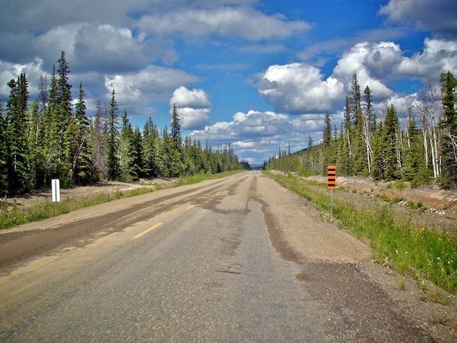
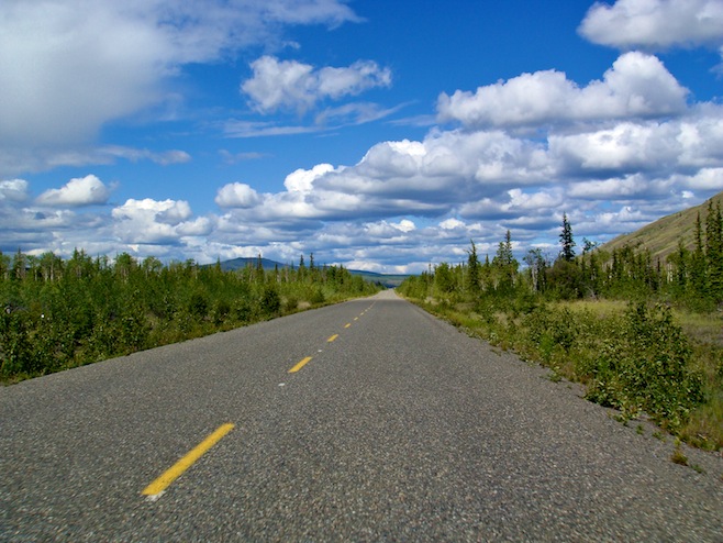
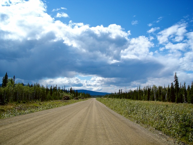
When we got in tonight we were sitting around when Ali suddenly decided to check our lights. Turned out we had a taillight out. Then we realized the brake lights weren’t working. Then somehow the blinkers stopped working. I spent hours trying to track the problem, but all I’ve managed to fix so far is the taillight. Still no brake lights or signals. Not a good thing when we’ve got a semi up our butt and our turn quickly approaching.
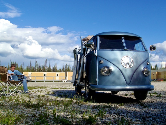
july 10 2008 : inuvik, northwest territories, canada
The Dempster Highway, 460 miles of unpaved highway, crossing the Continental Divide three times through two mountain ranges, and even better, crossing the Arctic Circle. When I saw this road on the map I immediately changed our route.
The morning after our brake light and turn signal debacle I woke up to have one more shot at things. The first thing I did was hit the turn signal to make sure that it hadn’t all been a bad dream. Before going to bed the night before the left signal worked fine but the right didn’t click on at all. Now, in the light of a new day, the left signal had crapped out on us, but the right signal had made a miraculous recovery. Still no brake lights though. I was actually happier with the right signal though because now I could at least inform huge speeding trucks that I was pulling off onto the shoulder so they could get around us.
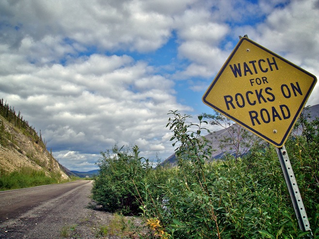
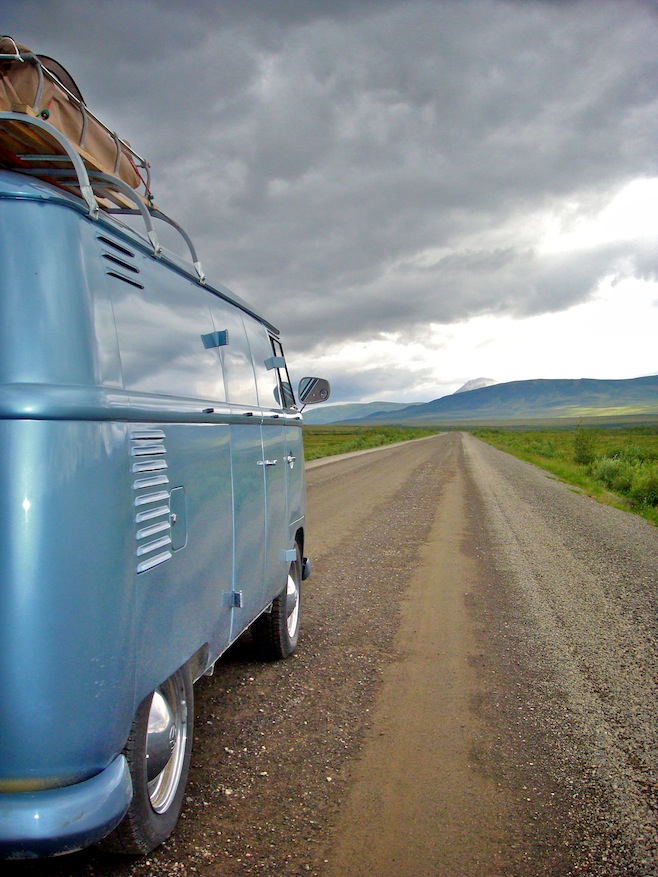
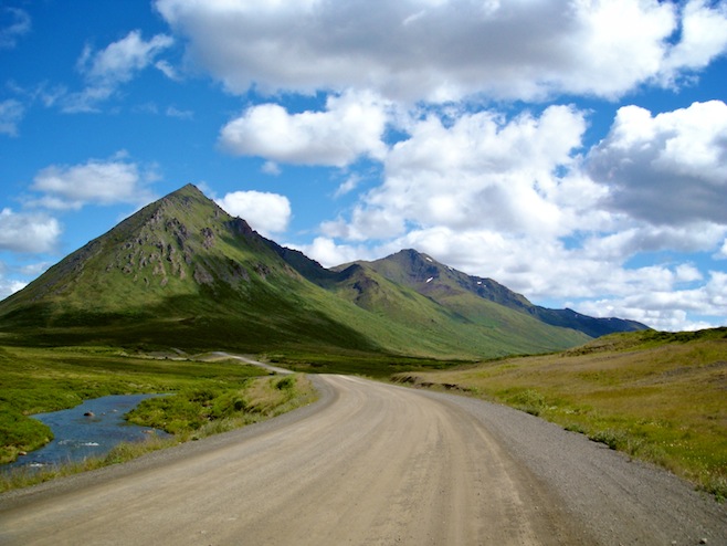
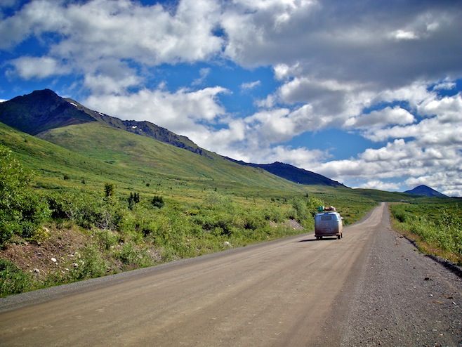
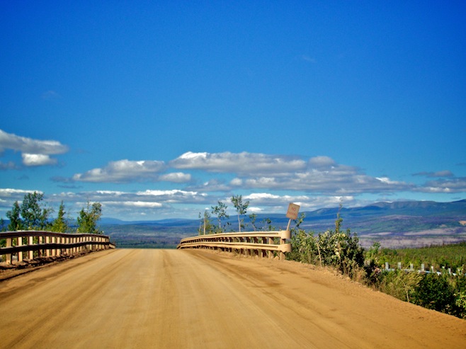
Onto the Dempster Highway we went, and after just a couple of minutes the asphalt turned to gravel/rock/mud/dust/dirt. Our two favorite road signs of the day were one indicating that there were bumps ahead. Funny since our teeth had been rattling for hours. The other was letting us know to Watch For Rocks on the Road. Never mind that the road at that point was nothing but rocks. Despite the rough conditions the road really was great. Especially the first couple of hours as we cruised through the mountains. After the mountains the road wound between, up, and through what to me would be considered mountains, but were probably more like large hills. Rivers, ponds, and lakes were everywhere, but we just couldn’t seem to spot any cool wildlife. We caught a quick glimpse of a bald eagle, but that was about it for the day.
The rains came late in the afternoon, turning the highway into a slippery, muddy mess. The almost complete lack of traffic made negotiating the conditions easier though, and around six we rolled into the Eagle Plains rest stop, the halfway point on the road where anybody passing through would be graced with the opportunity to slap down nearly eight bucks a gallon for the gas to carry them onwards. There was also a restaurant and bar there for us to refuel our bodies with more frozen burgers and fries. We met a group of locals there who had passed us earlier in the day. Their first comment was, “You made it!” They then told us that up in Inuvik this weekend was a big arts festival and the city’s fiftieth anniversary celebration. Good timing.
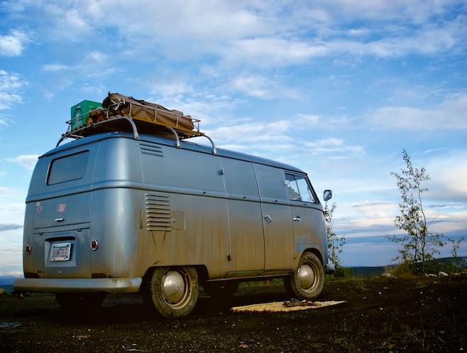
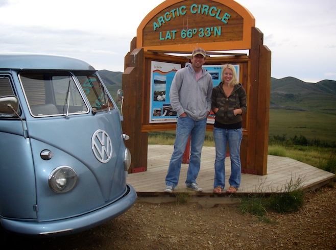
After a muddy, bug-infested night at the halfway point we continued on. Today’s journey quickly carried us over the Arctic Circle. Neither of us had ever been this far north in our lives, nor had we really ever had any intention of doing so, but here we were in a 1958 bus, looking about as out of place as two people can. The only other people on the road were truck drivers or locals in their one-ton six-wheeled Dodge trucks.
Later in the day were a couple of ferry crossings. The rivers weren’t large, and it seemed like it wouldn’t be a big deal to build a bridge, but I think the reason they don’t is because keeping the bridge from sinking in the permafrost would be nearly impossible. So instead they run a little ship back and forth all day long and don’t charge a thing for it, it’s just part of the highway.
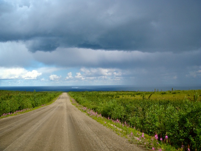
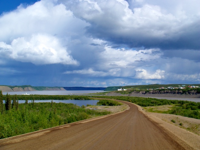
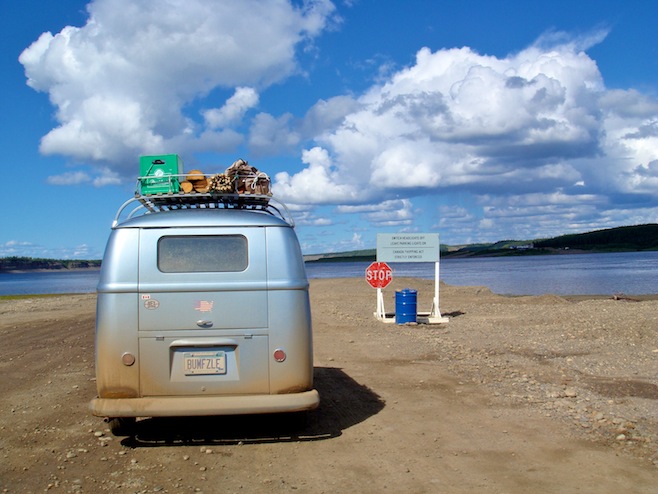
The further north we got the better the road got, which was a surprise to us both. In fact today’s drive was mostly at the almost unheard of speed of 40 mph. Not far below what we do on a paved highway.
Late in the afternoon we rolled into Inuvik, Place of the People. As we drove down the main street a truck pulled up alongside of us and asked where we were from. We told him Minnesota and they said, “And you made it up the Dempster in that? Awesome.” Ten minutes later we were talking to a guy at the restaurant and he said the exact same thing, word for word. Thirty minutes later we had just settled in at a campground on the edge of town when we heard, “Is that a Minnesota plate? You drove from there, all the way up the Dempster to here?” Everybody seems to think we’re a little goofy in the head, but they like it.
july 12 2008 : eagle plains, yukon, canada
The Inuvik festivities eluded us somehow. When we arrived at the building where the ten days of arts festival was supposed to be kicking off we only found a handful of people putting up tents. Granted, Friday would be a weird day to really kick things off. Same for the fiftieth anniversary celebrations, we seemed to be a week early on that one too. Fortunately for us the weather was amazing. We actually spent a good portion of the day sitting in the sun. I was busy working on the bus’ electrical issues, but Ali would call me over whenever the big white poofy clouds were about to pass. The instant the sun was clear the temperature spiked twenty degrees. Neither one of us would have expected to be this far north and have such mild weather. Apparently it was a bit of an anomaly.
Something I haven’t mentioned yet, but which has really been affecting our lives, has been the perpetual sunlight. Inuvik gets a stretch of 56 days with 24 hour sun each summer, and we are in the midst of it. It is truly bizarre to be going to bed in the bus with bright sun still high above the trees shining in our windows. And this is at midnight. Our clocks are so far off we can’t go to bed any earlier than that. The biggest problem though is waking up at four a.m. and still having that bright light shining in. It is nearly impossible to tell our bodies that it isn’t time to wake up yet.
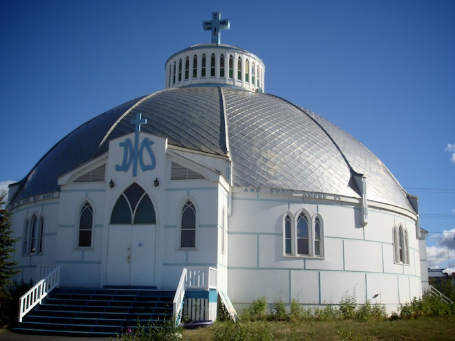
We wandered around Inuvik a bit, dropping in on a couple of stores, and checking out the igloo church. Overall though there just wasn’t a whole lot happening. There seemed to be an inordinate amount of kids around town. And why wouldn’t there be, come winter they’ll have a few weeks without the sun ever rising. I’d think each family would probably have one kid a year indefinitely.
We got to talking with a young guy who came up here ten years ago and never left. He said he loved to snowmobile. I asked what he did the rest of the time and he told me that he just worked, delivering food for the restaurant we were sitting at, and shoveling snow. He kind of laughed about it, obviously realizing these weren’t exactly stellar careers. But then he explained to us how, “Money is different here.” He said it was almost impossible to find a job that paid less than $25 an hour. Stupid jobs even. The tradeoff was that everything cost a fortune. A large pizza at the restaurant we were at cost over forty dollars. (We have been subsisting on cheeseburgers and fries, the only thing we can reasonably afford.) The rent for his 520 sq. ft. house that he shared was $1350/month. Yet he was happy as a clam as long as he could ride his snowmobile all winter long. It takes all types I guess.
july 14 2008 : chicken, alaska, usa
Our return trip along the Dempster seemed to go much smoother, with much less rain and almost zero truck traffic with it being the weekend. Both of which made for a much more enjoyable ride.
I forgot to mention too the other day that I managed to work out some of the problems we were having with the lights. Both turn signals turned out to be nothing more than 50 year old connections working themselves loose. The light bulb assemblies on each side are worn with age and aren’t all that tight anymore. While not the prettiest fix, they both benefited greatly from some electrical tape. The license plate light was fixed by adding a ground wire. Not sure if it never had one or what exactly happened there. But in the end, probably the most important lights, the brake lights, are still not burning. I have yet to track down the proper wiring diagram and after a couple of hours remained at a loss. I know it shouldn’t be this complicated, but wiring is simply not my strong point.
Anyway, after about 900 miles in a vibrating bus we hit smooth tarmac again. The minute we hit it I noticed that the steering seemed to have a lot of free play. Even Ali noticed right away. Looking over at me and laughing she said, “What’s with you steering back and forth? You look like a cartoon.” I did too, steering the wheel in big arcs while the bus continue on straight ahead.
Once we hit the gas station a few miles down the road we found out why. We had a flat. Not to the rim, but just about. I’ve become a big fan of Fix-A-Flat because it saves me having to do any work at all, so once again I busted out a fresh can, filled the tire back up, and we’re good as new again. Probably until tomorrow morning when I’ll wake up with Ali on top of me. She’ll blame it on the bus slanting from the flat tire, but I’ll know better.
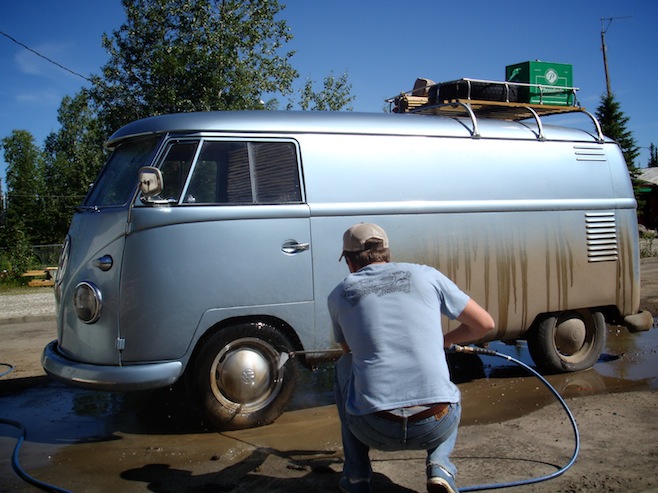
We spent the night right there at the gas station/campground, washing the bus, changing the oil, and cleaning the dust from every nook and cranny. Then this morning we drove down the road to Dawson City. We didn’t know much about Dawson, but it turned out to be a really nice little town. We visited the museum there and learned a whole lot about gold. Turns out Dawson City was home to the big Klondike Gold Rush. The town boomed for a few years until the easy pickings were gone and the next rush was on in Nome. Today the town is a tourist town, but surprisingly done really well. They’ve restored a lot of the original buildings, and even left a few alone, just as they were. The roads are dirt, and the sidewalks are raised wooden platforms, just like in all the old pictures. Overall a pretty nice place to spend a few hours wandering around.
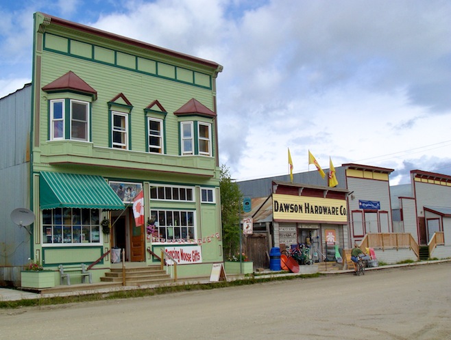
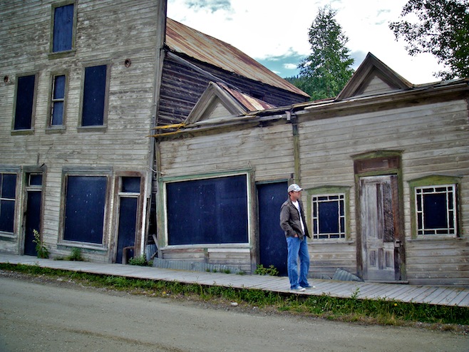
The road from there climbed up into the mountains. The Top of the World Highway took us right to the border, situated right up on the top of a mountain with amazing views stretching out in each direction forever. The officer took a look at our passports, then a close look at our bus, and said, “Nice bus. You know they used to haul a lot of drugs in these things. This was their vehicle of choice.” We both thought for sure that at that point he was going to ask us to step out of the car and was going to proceed to tear apart our cushions with a knife, but instead he just told us to enjoy our trip.
We ended our day in Chicken, Alaska. So named because nobody knew how to spell the real name, Ptarmigan, a game bird running all over the place up here. Today it is a tiny place in the middle of nowhere that has somehow become a tourist trap by selling t-shirts such as I Got Laid in Chicken, Alaska. I fail to see the humor in that, but I did like the big sign above the outhouse in the parking lot, CHICKEN POOP. Get it? Poop, coop. Ahh, toilet humor, nothing is more funny than that. The redeeming feature in all of this was that the restaurant actually cooked their food homestyle fresh. While we still couldn’t afford to eat anything other than a burger, at least it wasn’t a frozen hockey puck on week old bun. And the chili, oh the glorious chili.
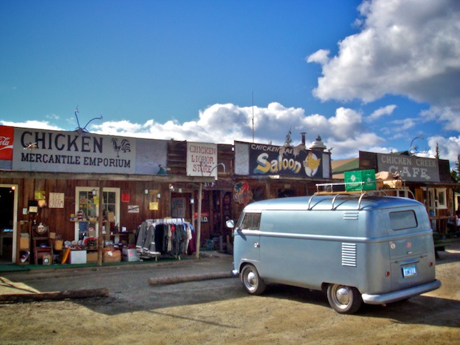
july 15 2008 : richardson highway, alaska
Our first full day in Alaska and it was the quintessential Alaskan summer day. God it was amazing. After a fun morning listening to old timers regale us with stories of the 60s when they were turning VW buses into Florida swamp 4x4s, we left Chicken behind. The sun was shining and the sky was so blue that everything else just seemed to pop out at us in 3D.
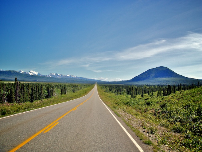
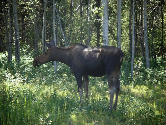
We turned back onto the Alaskan Highway for just the second or third short section of our trip, and again were starting to talk about how it was the least interesting of all the roads up here. The amazing thing about it though is that there just doesn’t seem to be anybody on it. Maybe a car every fifteen minutes or so. So when we spotted a moose standing along the road we just stopped right there and shut the bus off. Ali got out and was able to walk to within about 25 feet of her while she ate grass and pulled leaves off the trees.
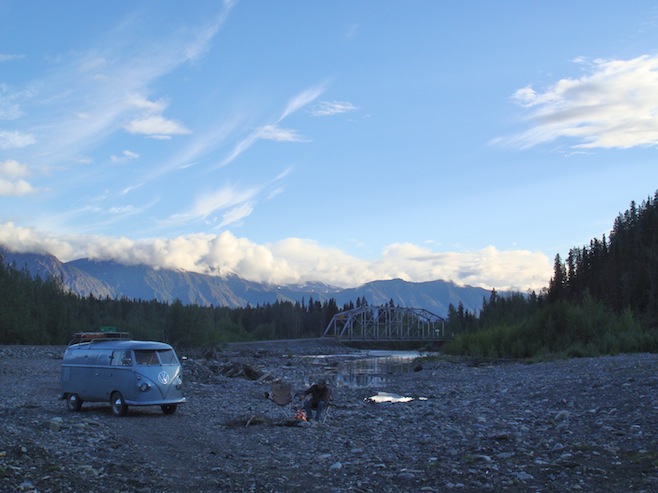
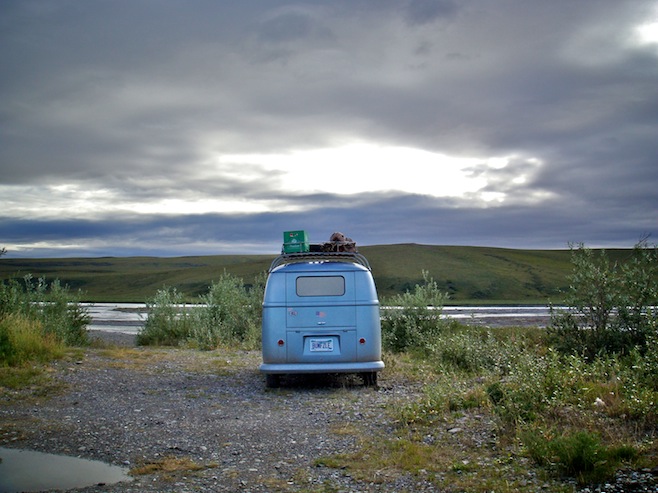
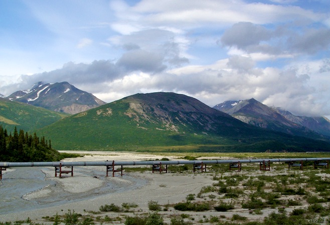
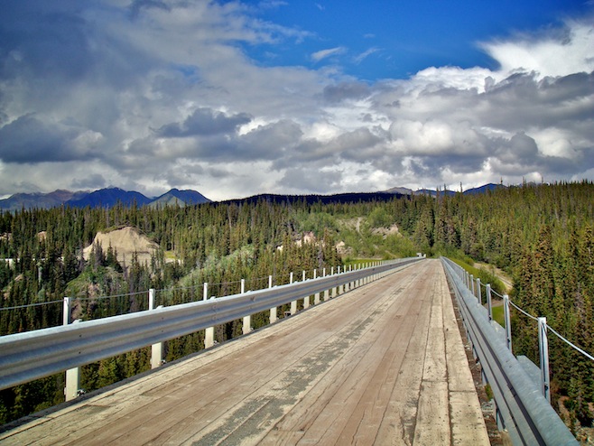
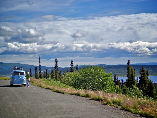
Then the highway really got back at us for everything bad we ever said about it. We came to a bridge across what was now just a series of creeks running through gravel, but had obviously at some point during the spring runoff been a full on river. Looking up the river bed into the distance was a line of mountains so beautiful that we once again just stopped, right there in the middle of the bridge. Then we spotted tire tracks down alongside the creek. We pulled off the highway, found a path through the trees, and drove right out into the middle of this amazing scene. For the next couple of hours we just sat there along the waters edge soaking it all in.
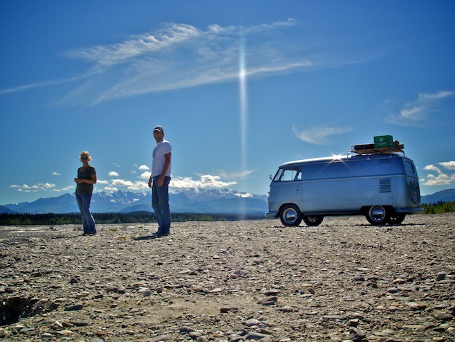
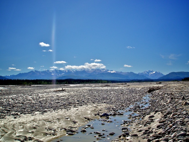
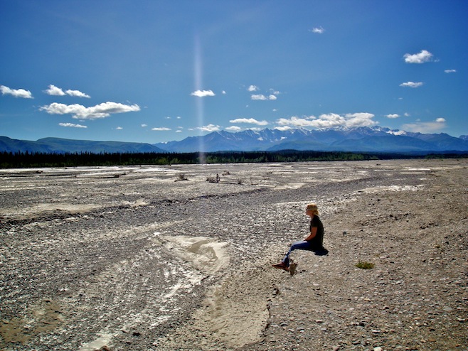
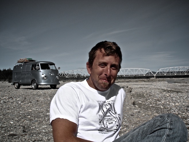
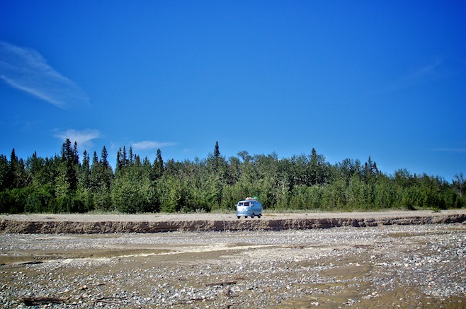
When I envisioned Alaska this was exactly the picture I had in my mind. For it to present itself to me on day one was incredible. We both can’t wait to see what else Alaska has in store. We really thought B.C. and the Yukon were beautiful, but just this one perfect day in Alaska blew them both away.
In Delta Junction we had a great lunner at a reasonable price, followed by a stop at the liquor store for some Alaskan Amber, again at a reasonable price, and then rounded off our trip through town by filling up on gas at three bucks a gallon cheaper than the day before. I have to stress that we really enjoyed our time in Canada, but it sure does feel good to be back in the States again.
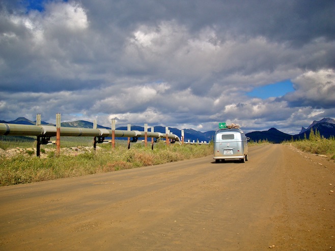
At the junction we once again pointed south, which brought us even closer to the mountains we’d been enjoying the company of all day long. We stopped to watch another moose wade through a pond eating the long grasses growing along the edge, and then pulled off the road when we spotted a small lake tucked in behind the trees. A nice picturesque spot with views of both the snow capped mountains and the Trans-Alaskan Pipeline headed south to Valdez, just like us.
july 18 2008 : mccarthy road, alaska
Valdez didn’t work out so well. It started to rain on the way down there, and the fog was so thick that at one point we were slowed down to fifteen mph. The rain didn’t let up either. For two days Valdez was just a white soupy mess in every direction. From the sounds of things that isn’t too unusual either. To top it off the high temp was fifty degrees. I’m sure the place is great on the rare day that the sun shines down and you can see the mountains hemming the town in on all sides, but I just can’t imagine any place being worth fifty degree high temps in the middle of July. That’s just insanity.
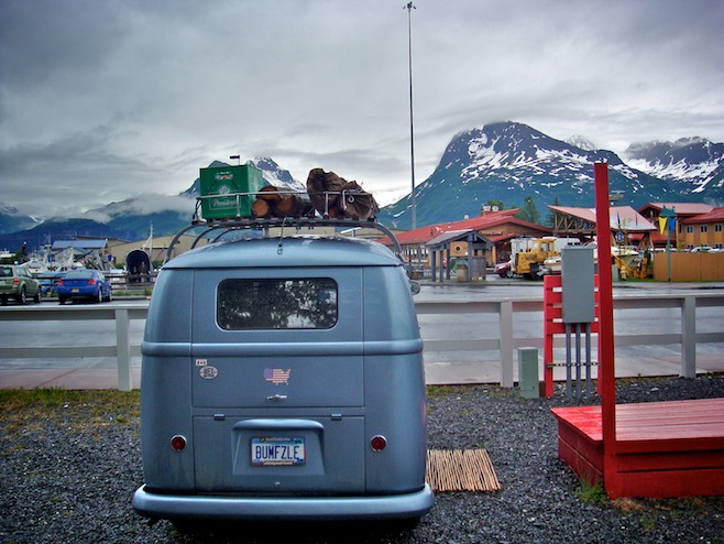
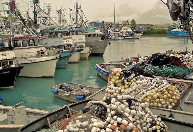
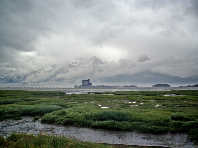
We did slop our way around the town though. The indoor entertainment was pretty slim, limited to a couple of museums and a couple of bars. We decided first the museums, then as a reward, the bar. The museums were pretty good, a little bit of gold rush era stuff, and then the main stuff recounting the day in 1964 when a 9.2 earthquake hit 45 miles away and basically swallowed a good portion of the town along the waterfront, along with quite a few of the townsfolk. In the end the town was condemned and relocated four miles away to where it sits now.
The best part of the day actually came on the way to the pub when we stopped off for some fresh halibut fish and chips. The chips were rubbish, but the fish was easily the best ever.
Today we woke up to more rain and decided we’d probably grow old hanging out there waiting for good weather, so instead we hit the road again. We retraced our route but this time swung off the road headed for McCarthy, about a hundred miles away down a nasty dirt road.
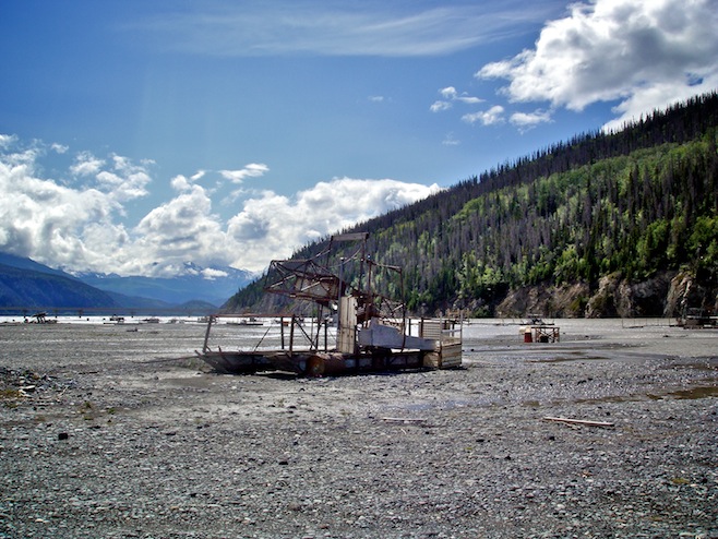
We crossed the Copper River, which as the name suggests once contained a whole lot of copper. Now it is chalk full of salmon fishermen. We drove down onto the gravel flats to watch the action, and I have to say, salmon fishing doesn’t seem very sporting. The river’s edge was lined with fish wheels which is basically a wheel with a couple of big baskets on it that spins in the current. The salmon swim into the baskets and are funneled into a holding pen. That’s it. I’m not positive about this, but I believe these are only used by the native people here. The rest of the guys were floating down the fast moving river with dip nets. These are just big nets on the end of a metal pole. They float down the river holding their nets down in the water and wait for a fish to swim into one. Again, that’s it. Like I said, not very sporting, but I guess that’s not the point if you are trying to feed your family or make a living.
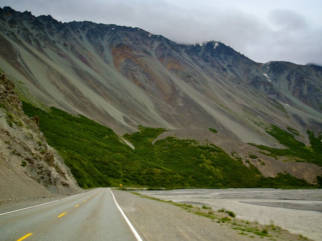
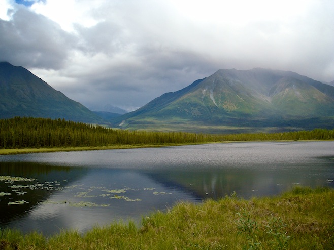
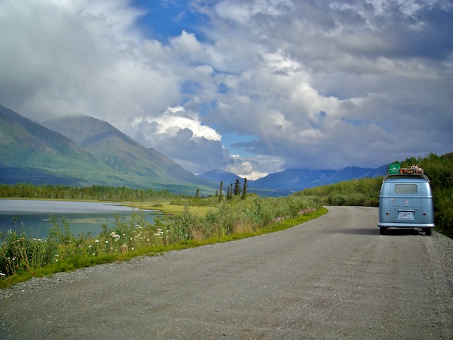
Further up the road the skies finally began to clear and Ali and I found ourselves another river, with a big dry gravel river bed for us to camp on for the night. Nobody around, a big driftwood fire, a towering mountain, and a river running alongside of us. Pretty nice.
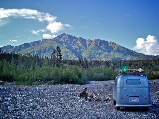
july 19 2008 : little nelchinn river (glenn hwy), alaska (126 nights in the bus : 21,133 miles)
Unfortunately we woke up to more bad weather this morning. We continued on to the town of McCarthy which is sort of unique in that the road ends and then you have to walk about a mile, across a couple of rivers, into town. I suppose it is also unique in that the very small town retains quite a few of the gold mining era buildings that sprung up here back in the early 1900s for just that purpose. Most of the buildings now house businesses there for the tourists that come to go flightseeing around the nearby glacier. The glacier was a five mile hike away, but seeing as we could only see a hundred yards it hardly seemed worth the effort. We didn’t stick around long.
Tonight we ended up camped right alongside a river, of all things. It seems that here in Alaska wherever there is a river you are free to set yourself up.
july 21 2008 : homer, alaska
We’ve been planning on going to see the grizzly bears feasting on salmon, and from what we’d read it seemed that those trips left out of Homer. So we made a beeline for Homer, passing right through Anchorage and Soldotna with little more that a stop at Taco Bell. It was actually kind of strange seeing fast food again. In Alaska you do tend to forget that you are still in America. Right up until you hit the Anchorage suburbs that is.
Driving in Alaska I had sort of gotten used to the fact that I could pretty much stop in the middle of whatever highway I was on, get out of the bus, water a tree, and get back in to continue on, all without even pulling over since there are so few cars on the road. As it turns out that is because the entire state lives within a fifty mile radius of Anchorage. Suddenly driving forty miles an hour was no longer acceptable. For that matter neither was driving fifty-five. I began to wonder just how important brake lights were after all.
The road south of Anchorage to roughly Soldotna is very pretty, assuming you are driving a modern car that has both variable speed windshield wipers and the ability to cruise along at eighty. Otherwise it is a white knuckle road. In order to get a moments relief we pulled off at the Alaska Wildlife Conservation Center, where they rescue, raise, and rehabilitate wild animals. We arrived just in time for the grizzly feeding where we got to watch a little four hundred pounder rip away the flesh of some road kill moose. Caribou, elk, bison, moose, they were all represented. The Center was a nice place doing a good thing for the animals, and we even learned something new. Who knew that reindeer are just domestic caribou? Wild caribou are caribou, and domestic caribou are Rudolph.
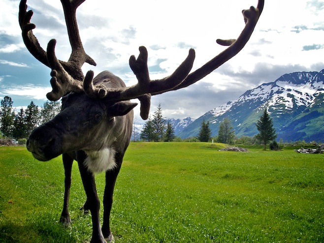
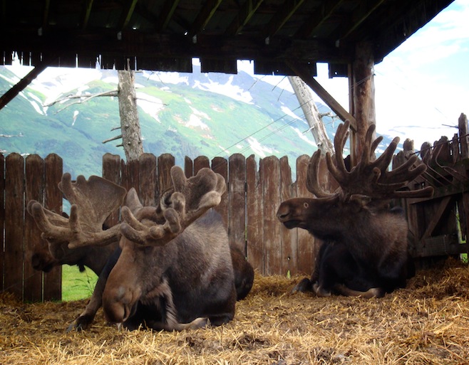
After spending the night alongside a tranquil lake we took off in the rain again to continue to Homer. Thankfully the traffic thinned out and instead of a lineup of twenty to thirty pick-up trucks behind us we only averaged five or six.
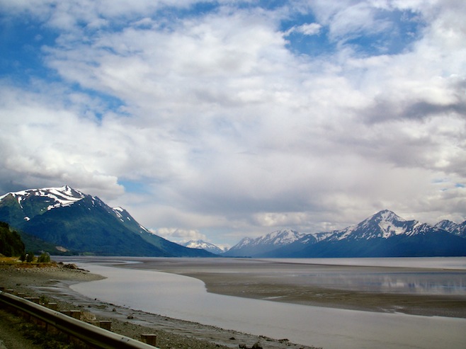
Homer seemed like a nice place, though we were having a hard time seeing it through the rain. And at forty-five degrees and windy we couldn’t spend too long outside without risking frostbite. Silly us not packing our mittens for a mid-July visit. We did the sensible thing and found a warm coffee shop in which to while away a couple of hours before heading to our campground out on the Homer Spit, a narrow five mile stretch of land sticking out into the water where tourist shops and RV parks have set up shop.
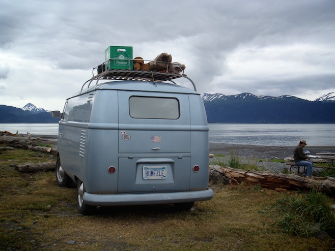
Before leaving town though we noticed a line of people outside the local one screen movie theater and decided to join them. This was small town America. The movie started a half hour late because they wanted to make sure everybody had their snacks and was settled in. At the snack stand they brought your bag of popcorn to you half filled so that you could salt it before they filled it the rest of the way up. I’d never seen such a thing. It slowed the process down tremendously, but it was just so nice who could complain. Then before the movie started, the lady who owned the place stood up at the front of the theater and made the announcement that if she saw the light from anybody’s cell phone during the movie she would come down and take it away from them and if they didn’t like it they could leave. That was the most enjoyable movie experience we’ve had in a long time.
july 23 2008 : kasilof, alaska
Our plan for Homer was to book ourselves on a bear viewing trip. Floatplanes take off from here and fly a hundred miles to the Brooks Range where the bears are gorging on salmon. Brooks Range is where all those famous pictures of bears standing at the top of a small waterfall catching salmon as they jump right into their mouths are taken. Typically we walked into the bear charter business without any reservations expecting to take off the next morning. We really aren’t ones to plan much in advance, especially since we have no idea when we’ll ever arrive anywhere.
Well, turns out nobody else has this problem. These places were booked solid. We really wanted one particular trip that was run by a couple of famous bear world people and actually takes you in the back country looking for grizzlies instead of just dropping you right in the parking lot with all the other tourists getting that famous waterfall picture. But they were booked until late August, so we left and parked ourselves at the coffee shop again to peruse the internet and weigh our options.
In the end we decided to roll on back through Homer in a month. It would seem silly to come to Alaska and not do the bear trip, as it was the one thing that we both really wanted to do. After booking that we hit the road again, headed back north the way we’d come. The thing with Alaska is that just about every road simply reaches an end somewhere. There isn’t a whole lot of looping and connecting.
We had just received an email from a Bum follower who told us he had a cabin just up the road from us that we were free to use. Seeing as it was absolutely pissing rain we decided to pop in there, relax indoors for the rest of the day and then crash in the bus for the night.
On our way down the highway we had to stop as a cow moose and a baby trotted across the road right in front of us and the GIVE MOOSE A BREAK sign. We pulled off and watched the two of them eat for a while and then got back on the road where we quickly found another group of moose causing traffic problems. They seemed to be everywhere all of the sudden, and seeing them up close on the road it was easy to imagine the damage that one of them would do to us in a collision.
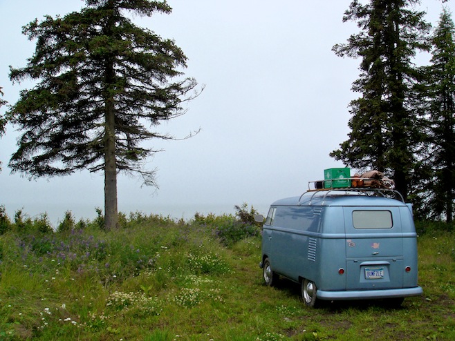
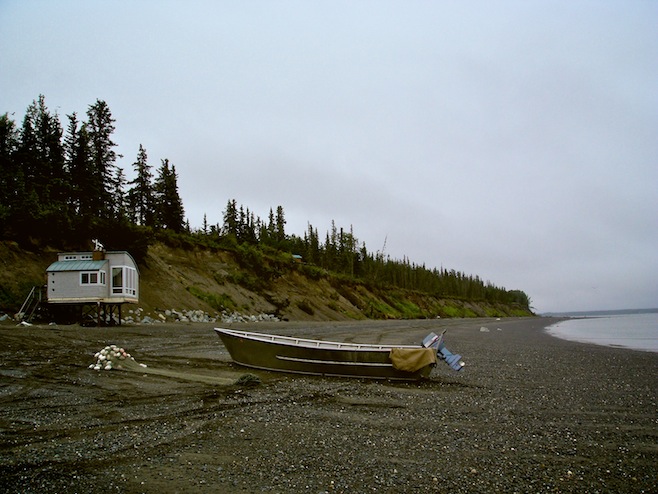
We found the cabin which turned out to be a very cool place with a parking spot up on a bluff high above Cook Inlet with waves lapping the shore and no view beyond due to the pea soup weather. The cabin itself was down below, right on the beach, with no other homes in sight. We spent the rest of the day sitting inside reading and watching the fishermen come and go. One thing that we saw in the cabin that we thought was about as Alaskan as you could get was the .44 Magnum hanging up right next to the door. As casually as an umbrella. Later we noticed a note mentioning that if you were going to hike up the hill to the historic cemetery that you should absolutely not forget to bring your gun, the bears were known to hang out there as well.
july 24 2008 : seward, alaska
The next day we woke up to find the rain hadn’t let up, but we decided to press on to Seward and hope for the best. Along the way we decided to check out the Russian River. The day before we had heard a lady warning a friend not to go there as it was stupid to get that close to wild grizzlies. Stupid? Bears? Perfect. When we got to the park entrance we found that the place was packed with fishermen. The real kind, with poles and hip boots, not just big nets. Apparently this is why the bears hung out here, to take advantage of the easy pickings left over after the fishermen fileted their fish.
At the park gate we found out it cost eleven dollars simply to park there. We hemmed and hawed and decided to bag it, but the guy working the gate said, “Dude, I’ll let you in free. That bus is sweet.” He sounded like he’d just crawled out of the back of a bus himself.
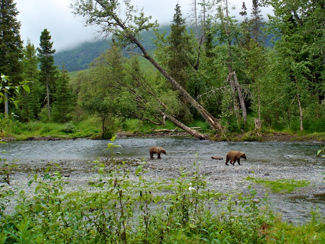
Hiking down along the river some fishermen told us there were a couple browns in the water about a half mile down. We quickly made our way down there, and sure enough, two brown (grizzly) bears were hopping around, splashing, and picking at a salmon carcass. We were able to watch them from just thirty yards away for nearly an hour. A couple of times they made their way to the shore and we had to beat a hasty retreat. The few fishermen that were in the area didn’t seem to care too much about them, but did make sure to keep their distance. It was pretty awesome to get to see them like that. When we finally made our way back towards the car we spotted a big black bear momma and her two tiny cubs. They were walking right along the edge of the river on the other side until the mom spotted a salmon carcass, reached down into the water, scooped it up, and ran back into the woods with the cubs to eat.
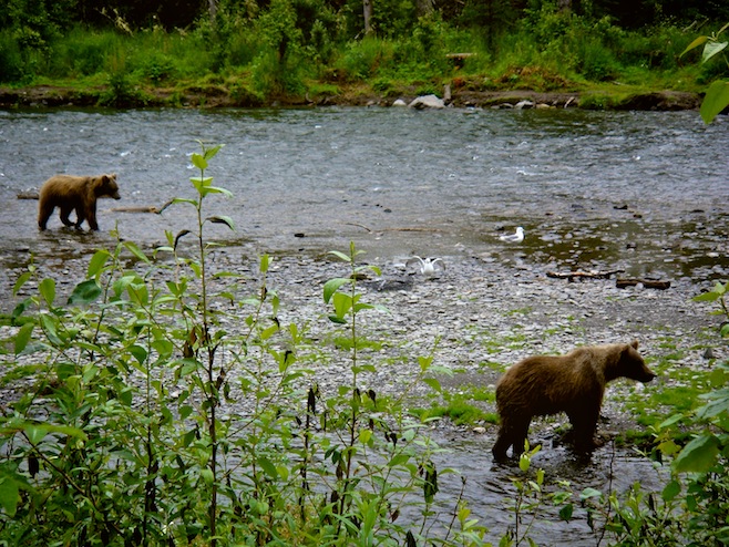
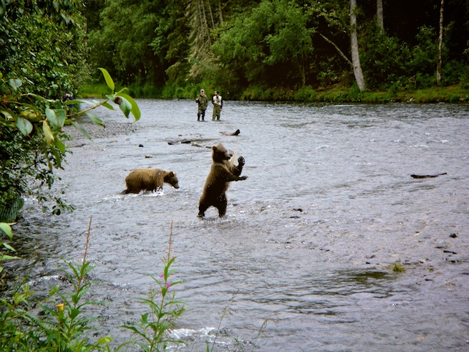
When we got to Seward we found the weather was no better. We couldn’t see a thing outside so we took refuge in the Yukon Bar. We needed to stay dry somehow. Then this morning we woke to still more downpours. Living in a bus is great when the weather is good, but after a few straight days of heavy rains it really begins to suck. And today the rain finally defeated us. We checked into a hotel. It’s funny, we almost have like this guilty feeling for doing it, like we’re wimping out or something.
july 25 2008 : bear valley (outside of Whittier), alaska
We gave up on Seward today, but not before hitting the Alaska Sealife Center. The guidebook made this place sound amazing, but Ali and I buzzed through it in an hour, despite reading every display, and watching the seals, puffins, and salmon swim around in their habitat displays. Really overrated and overpriced as far as we’re concerned.
On our way out of town we visited Exit Glacier, which was yet another block of retreating ice. I think in Alaska a person could be forgiven for becoming a little glaciered out. They are everywhere, and very accessible. I think we’ve probably reached that point now. As we were about to get back on the highway Ali asked if we needed gas. I’d sort of forgotten about it but figured we had fifty miles worth left and didn’t feel like driving the six miles back into Seward so we continued on. Of course the next two small towns were gas station free and soon we were sputtering our way up a hill. I should mention here that just three days earlier, in Homer, we were driving through town when we ran out of gas. I don’t know what my problem is all of the sudden, but I can’t seem to be bothered to check our mileage (we have no fuel gauge).
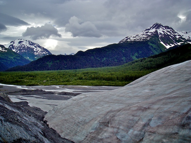
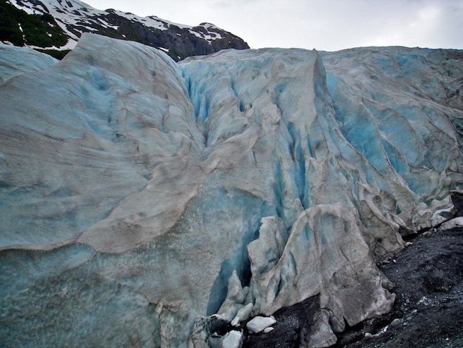
Anyway, we pulled off on a beautiful scenic overlook, and I poured our one gallon can into the bus. Before we drove away we took a look at the map and determined that the next town was a good forty miles away. About seventeen miles further than we were going to be able to drive. So I decided this seemed like as good a place as any to try and rustle up some more gas. Just then a camper pulled in behind us so I went to ask him if he had any. He didn’t; he had a diesel truck. He said he’d seen us in Seward and kidded me about not planning very well. I laughed and said that I’d spaced out. Then he caught sight of Ali and told me he could see why I had been too distracted. Helpful fella.
I grabbed my empty gas can and stood along the road. I thought this would be sort of a fun little experiment, seeing how long it took to score a couple gallons of gas. Ali waited in the bus, laughing at me and taking pictures.
Within a minute a car with a couple of ladies stopped and asked, “You wanna ride to Girdwood?”
“Sounds fun ladies, but I’m married. Thanks anyway.”
They looked confused, and then the passenger said, “My husband saw your bus in Homer the other day and couldn’t stop talking about it.”
Husband? Homer? D’oh!
Two minutes later a pickup pulling a boat pulled in. Exactly the sort of guy I was hoping would see us. Anybody with a boat has a can of gas in it. He actually would have been there quicker but he had to go past and then turn around to get to us. Nice guy. He didn’t even want to take any money, but I finally convinced him. At five bucks a gallon who can afford to do a good deed for free anymore?
Flush with seventy-five miles worth of gas in the bus we made a detour for Whittier. Whittier sprung up during WWII as a secret Army base. Completely surrounded by towering mountains with just a tiny opening out to sea it was a pretty good choice. They blasted a three mile long tunnel through one of the mountains to get there and now that is pretty much the draw. The town itself consists of a rather large small boat harbor, four restaurants, five gift shops, and a hulking fifteen story building that looks really out of place in that setting. We didn’t spend a whole lot of time there, drove back through the tunnel, and found a place to boondock next to a swiftly flowing glacial river. Now we’re sitting inside listening to the rain pitter patter on our steel roof. An all too common sound lately.
july 27 2008 : susitna river (parks hwy), alaska
In the morning we made our way to the gas station at last. Just as it came in to view I felt the bus hesitate. A few seconds later she died. We coasted a few hundred yards and I got her started up again, and managed to build up some speed before she died for good. We coasted and coasted and for a few seconds I thought we were going to make it to the station, but then the road narrowed for a small bridge and we faced the prospect of losing our shoulder with cars roaring up behind us. For the third time in just five days we were out of gas. That has to be some sort of record. I grabbed my empty gas can and jogged the final two hundred yards. We were so close. I had explained to Ali that by not filling up in Seward where we should have we were sticking it to the man. Gas there had been sixty cents more than up here. Though by the end of this it felt more like the man had stuck it to me.
We ended up in Anchorage for the night where we were treated to some proper Australian hospitality by some Bum friends of ours who manage a couple of hotels there. A dry place to sleep and a night on the town, what could be better?
Anchorage itself isn’t all that exciting a place. During the day we walked down to the Saturday Market which was pretty nice as far as markets go, and we checked out the salmon fishermen down on Ship Creek. But for the most part we got the feeling that Anchorage is just sort of an overnight rest stop for people headed somewhere else.
Today we drove north to Talkeetna, a small town up a spur road which supposedly is the first spot you can get a good view of Mt McKinley. We wouldn’t know about that though. We did see some blue in the sky today though and have high hopes for more to come. We did hear it reported that this is officially the coldest and wettest summer on record up to this point. Though there is still another week or so of summer left before winter begins.
Talkeetna was sort of a funny little town because of the massive amounts of tour buses flooding the streets with wide-eyed lower forty-eight folks. The town is really only one block long so the number of people seems a bit out of place. We drove the block, turned around and started making our way back through the throngs. It felt as if we were driving in a parade. We kept getting stopped by people asking about the bus, asking where we were from, and telling us their own bus story. At the end of the road we were stopped again by a nice guy who quickly offered to let us camp right there in the parking lot of his building. He then grabbed us a beer and showed us around the bar he was building.
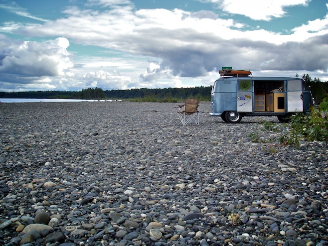
We walked around the town, checked out an awesome secondhand bookshop, hung out in the historic main street bar for a little while, but in the end decided to get out of town and find a place to ourselves. We didn’t have to drive too far before we saw a bridge and we both sat up a little straighter. Where there’s a bridge there’s a river. And where there’s a river there’s an awesome place to camp. Pretty much every time right after the bridge there is a little dirt road off to the side which we follow down onto the expanse of river rock and pick out any spot we want. No people, no bugs, and great scenery. And tonight we have the added bonus of a whole bunch of bear tracks right in front of the bus.
july 29 2008 : manley hot springs, alaska
We woke to gray skies, but the ground was dry and mud free for the first time in weeks so I took the opportunity to slip under the bus and adjust the valves. It always surprises me what a difference just those minor adjustments can make. Our engine purrs like a kitten. We finished that up and started up the road just in time for the rain, coming down in sheets as we drove by the Mt McKinley south viewpoint and then the north. It really feels hopeless at this point. We couldn’t see a hundred yards, much less a few miles out and 20,000 odd feet up.
We killed a couple of wet hours in a restaurant, then on the side of the road staring at a rapids filled river and tour bus after tour bus. Right now we feel sorry for two kinds of people, those on a one week holiday and those on a motorcycle.
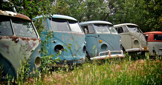
I figured if we just kept driving in one direction we were bound to break out of the rain, and right before giving up for the night we finally did it, stopping in a little campground in Nenana. The place turned out to be the cleanest and most reasonably priced in all of Alaska as well. Ali spent a couple of hours there jabbering with the old guys about the bus while I tried one last time to work out our brake light problem. It looks like the problem is going to end up being the switch inside the master cylinder, not the wiring, and will require a part to be ordered at some point. For now we’ll just continue on with Ali freaking out any time a truck is behind us and I see a turnoff later than I should. During her conversations with the old guys we did get pointed down the road to a VW graveyard. There are some splitties in there that should definitely be saved.
The clearing sky of last night gave us false hope this morning when we were surrounded on all sides by brilliant blue. It didn’t last long though, and by the time we’d driven north for an hour we were back in the muck. We haven’t taken a picture in days.
By the afternoon we were rolling through Fairbanks. What a god awful looking sprawl of a city that was. The whole place had that industrial airport maintenance road feel to it. Cheap gas and Taco Bell were all that was on tap for Fairbanks. We were quickly out of town and headed north towards, yet again, the Arctic Circle.
An hour north of the city we got off the main highway and turned west for the town of Manley Hot Springs. I feel weird admitting it, but Ali and I have never been in a hot springs bath before. We always thought they sounded just like a hot tub, for which we are not too fond of either. But the Manley springs sounded nice, and the hundred mile dirt road to get there sounded like a mini-adventure in itself so we decided to give them a shot.
The road out turned out to be in really good shape as far as dirt roads go, and in no time we were at the Manley Roadhouse. The roadhouses here in Alaska are great. Hulking buildings with rooms for rent upstairs, and a big restaurant and separate bar downstairs. This one was nicely restored; or maybe just kept up. We tested out the barstools there and then went back down the road to the hot springs themselves.
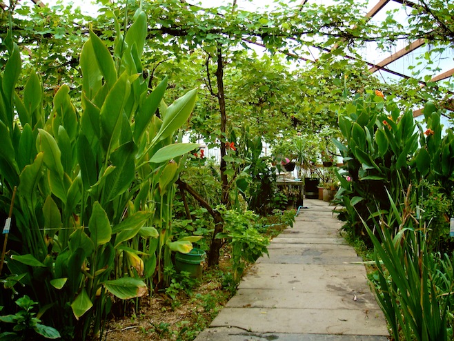
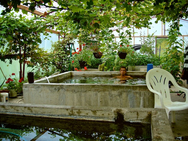
The hot springs were housed in a big plastic greenhouse, with grapevines and fruit trees all over the place. In the middle of it all were three big concrete tubs with steaming water. Super hot, really hot, and pretty darn hot. The place was kind of weird, nobody else was around, and there were no changing rooms. It almost felt like we were missing something. We changed quickly behind a jalapeño bush or something and hopped in for a soak. Now a couple of hours later we are sitting in the back of the bus listening to the rain on the roof feeling clean as a whistle.
We’ve been in Alaska fifteen days now, and due to the weather we’ve kept moving a bit more than we normally would have. Our Alaskan totals so far are 2290 miles, with $492 spent on 102 gallons of gas. Restaurants have been the real budget killers for us this month though. In July we will have set a Bumfuzzle travel record on food, surpassing $1000 for the first time ever. And that’s on one meal a day washed down with a bag of chips or something before bed.
july 31 2008 : dalton highway, alaska
The Dalton Highway; 450 miles of oil money funded adventure to the Arctic Ocean. After backtracking down the road to Manley the road teed off and we pointed still further north. The road immediately became dirt, but it was so smooth it was like driving on one of those pillow top mattresses. The real challenge on this road are the hills. Now, two days in, I’ve had to downshift to second gear at least a dozen times, climbing mountains at speeds as low as twenty.
On day one we first crossed the Yukon River along the only bridge in Alaska to do so. The river flowed quickly by, muddy brown, while up above the sky turned blue for the first time in what seemed to us to be forever. We stopped off at the Hotspot restaurant there as it would be the only one we would be driving past that day. The burgers were trucker sized and, because they were over a pound already, they didn’t bother with fries.
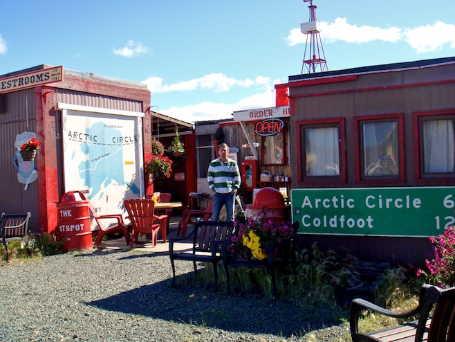
By late afternoon we found ourselves, for the second time in three weeks, at the Arctic Circle. After a few obligatory photos we made camp and settled in with a couple of beers and some late evening sunshine.
Today the scenery really took off. The Brooks Range came into view in the morning and gave us stunning views all day long. We stopped in Coldfoot for lunner and the last gas until Prudhoe Bay on the Arctic Ocean. There we overheard some truckers talking about the snow they got the night before just up the road at Atigun Pass. Sweet, July 30th snowfall.
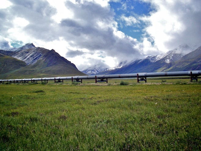
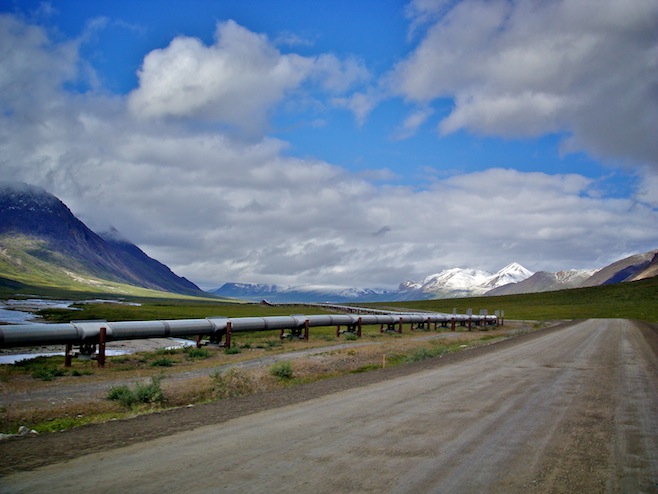
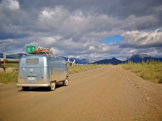
Along the road today we realized just how polite everybody was. Every single truck and car slows down when passing each other so the other person won’t get “rocked.” It’s made for some very civilized driving in an otherwise uncivilized place.
The Atigun Pass was spectacular. The mountains all around stood out in sharp points. None of these big flat topped or rounded mountains here, these were the real deal, jagged, forbidding, and piled one on top of the other as far as you could see.
Then, just as dramatically, the mountain range ended and rolling green permafrost hills and ponds started to dominate the landscape. As we drove along Ali and I both spotted something off to our right. We pulled over and could see for sure that it was a huge caribou rack sticking up out of the weeds. It was 150 yards out from the road, but I saw a small hill about fifty yards away from him that I could sneak up behind. So I set off across the permafrost, sinking and squishing with every step. Within seconds my feet were soaked from running on the wet sponge. When I came up to the small rise I stepped up on top and was right there next to the caribou. A few smaller ones got up from nearby and started to trot off. After a few more seconds the big daddy with his huge rack finally stood up, took one disgusted look at me, turned and walked away.
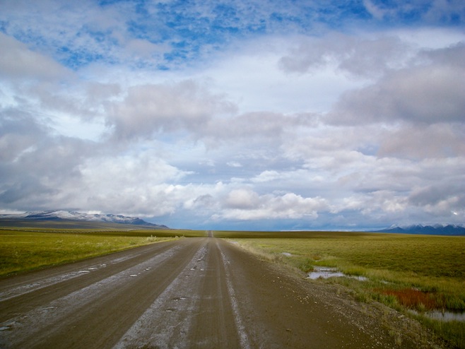
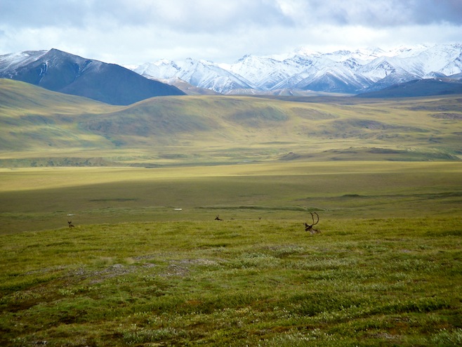
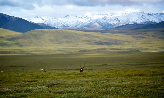
Back in the bus it wasn’t long before we spotted more. First a big herd of muskoxen which were all just lying there looking like rocks. Then more caribou. The caribou herd in this area is supposed to number 31,000 strong, and today it felt like we saw most of them. Huge groups of them crossed the roads and gathered in the fields. When we finally felt like calling it a day we pulled off on a little side road with a view over a river and the surrounding hills. Soon we watched from the bus as a herd of at least 300 gathered across the river from us. A few hesitantly made their way into the water, and then more and more, until it seemed they were all in there washing downriver together. The current was strong and they were moving fast, but eventually began climbing out the other side.
We waited quietly while they made their way up the steep embankment. The first group appeared about ten yards away from the bus, looked at us, sniffed, then continued on. They must have alerted the rest of the group though because everyone else made their way about fifty yards further downstream before popping up into the field. The whole experience was amazing and we were both pretty much giddy with the excitement of being that close to so much wildness.

.jpg)
.jpg)
.jpg)
.jpg)
.jpg)
.jpg)
.jpg)
.jpg)
.jpg)
.jpg)
.jpg)
.jpg)
.jpg)
.jpg)
.jpg)
.jpg)
.jpg)
.jpg)
.jpg)
.jpg)
.jpg)
3 Comments on “July 2008”
I just wanted to leave a note and say that I loved reading this!!! My husband, boys and I live in Colorado, but may be moving to Alaska this year. My hubby is in the Air Force and may be transferred to Clear base in Anderson, Alaska. This is 20 miles south of Nenana AK, which you talk about…they have the Volkswagen graveyard. Anyways, as we are looking at homes in the area, we found one in Nenana, one in Anderson and then tons in Fairbanks. I laughed out loud at your description of Fairbanks. It was exactly what I needed to hear.
Anyways, thanks for the great read. I am not sure what we enjoyed most, the writing or the photos (speaking of which-what were you using to shoot your pics?)!!!
Thank You so much. I want so badly to visit Alaska for one whole year and take it all in. I just don’t have anyone to do it with. Hopefuly maybe someday.
Thank You again,
Joseph
Wow! Loved reading every word and enjoyed the photos. The adventure north is awesome and to do it in a 58 Split makes it even more interesting.
We’ve made 9 trips to Alaska from Kentucky, all in two different VW Vanagons (non-westy). We made the first trip in 1986. We did the Dempster in 1993 (and far to the east, we went to Yellowknife in 93 as well). We’ve been back to the Arctic Circle on the Dempster several times. We’ve only been up to Levingood north of Fairbanks. We did go to Circle in 2016.
For those who can find the time, you need to follow your dreams and take the road(s) to Alaska and enjoy as many side excursions as possible on the way.