In the morning when the winds should have been dying down they just continued to howl. The thought of spending the day stuck on the boat in that mess led us to raise the anchor and head further north to Isla San Francisco which conceivably might not be any more protected, but we figured if we got there and it really sucked then we’d press on nine more miles to a well sheltered bay.
It was an uncomfortably rolly ride north, but nobody got sick and nothing broke, so once we had the anchor down we could count it as a success.
Isla San Francisco has a popular crescent shaped bay anchorage, but that was wide open to the weather so we went around the backside to what could be described as an indent. I’m not thrilled with the place, but it should do the trick for this south-westerly weather.
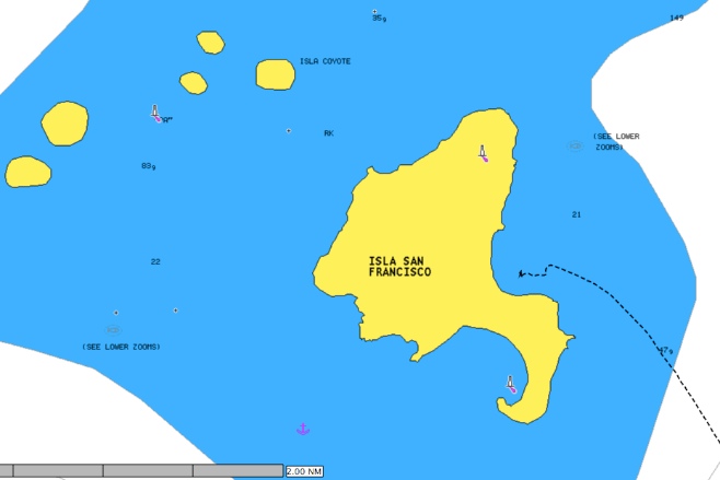
I’ve been sort of withholding judgment on our charting system, but have finally concluded that it sucks. Maybe not the charting program itself, MacENC (adequate but not exceptional), but the charts that you have to buy to use with it. They are Navionics charts and I couldn’t be more disappointed in them. We used C-Map charts on our last cruise and couldn’t find words to describe just how amazing they were. Expensive as all hell, but detailed and accurate as can be, especially in anything that could be considered a popular anchorage. But these Navionics charts have been lacking in just about every anchorage so far in Mexico. Here is a screenshot of Isla San Francisco. That’s as detailed as it gets (despite those little notes to see lower zooms). A wall sized map of the world would be about as useful for navigating.
