november 5 2007 : portland, oregon, usa
We’re packing up and getting ready to drive on, after nearly five weeks in Portland. We feel like we haven’t been in one place for so long in years and are excited about hitting the road again. We’ve been finishing things up here and hanging out with friends a lot. It’s always fun to go out with people who really know the city. The other night we ended up at a restaurant underneath a bridge downtown where I had an oyster shooter appetizer, spicy SPAM macaroni for a main, and a Mickey’s Malt Liquor to wash it all down. That’s a combination we’ve never seen before and are hoping to never see again.
We also took my mom out to buy a new car the other day. Some people get a little freaked out by the prospect of dealing with car salesmen, and it’s true they really are pretty annoying most of the time, but I kind of enjoy the haggling. Especially since the advent of the internet, where I can research the true cost of a car. Walking into the showroom knowing exactly how much the car cost the dealer makes the job of making a deal pretty brainless. Plus there is always the fact that the salesman needs to make a sale a heck of a lot more than I need to drive away in a new car. So I had some fun going back and forth with the salesman while my mom sat next to me playing the straight man with her lips sealed tight.
In the end we did drive away in the new car, only to discover when we got home that there were no floor mats in the car. Who ever heard of a brand new car not coming with floor mats? I thought I had gotten the best of them, but I guess the salesman got the last laugh this time.
november 8 2007 : fall river mills, california, usa
Back on the road yesterday we drove from Portland to Detroit, non-stop. Detroit, Oregon is in the Cascade Mountain Range, and the drive there was really nice. It was heavy forest, mostly that thick wet green type that clings to the sides of the road. From there we continued through the mountains to Bend. Bend is famous for its outdoorsy lifestyle. There are plenty of mountains nearby, and a river running through it. Basically any outdoor activity is available, which is why the town blew up in the last few years during the real estate rise. We didn’t give the place a lot of time, but we really weren’t feeling it either.
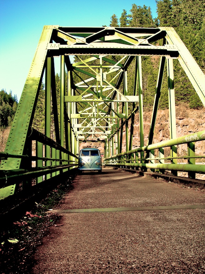
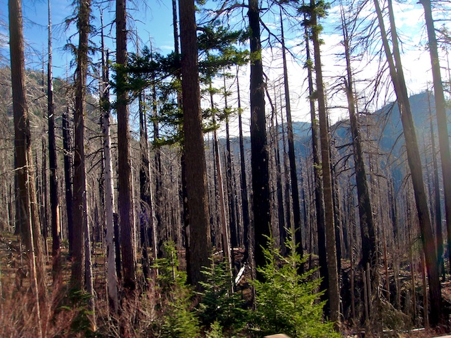
There is a main downtown area that has the look of a town which has recently been remodeled, meaning dozens of coffee shops and a bunch of real estate offices. The roads leading into town were typical ugly sprawl with mile after mile of Walmart and Applebee’s. The shining light was McMenamins, a brew pub in an old converted school house downtown. When in Oregon, search out a McMenamins near you. With temps dropping into the low 20’s overnight we searched out a cheap motel, which wasn’t hard considering it is off season and the town appears to be running at about 1% capacity.
This morning we made our way south to Crater Lake. The main road south was terrible, with tailgating truckers the entire way. Though once we turned off to the park things changed, and we had the road to ourselves. We were happy to find that because of the time of year the ranger station was closed, meaning no ten dollar fee for us. As we climbed the volcano the snow got deeper and deeper. In fact tomorrow’s forecast is calling for heavy snowfall, meaning the road will probably be shut down. Once we finally reached the top we parked the bus and walked up over a hill to an amazing view. Just like that we were standing thousands of feet up on the rim of a volcano filled with the deepest lake in the U.S. far below us. It was an awesome site, and we were all alone to enjoy it.
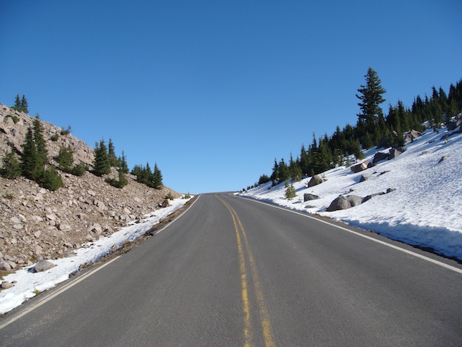
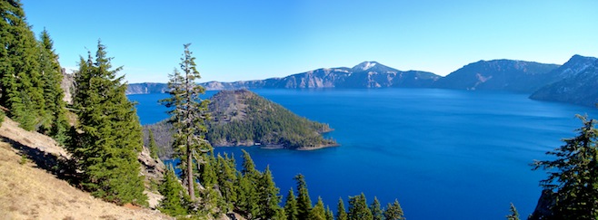
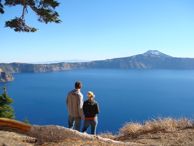
We hung out there for a while, Ali taking pictures, and me seeing how far I could throw rocks over the edge. By evening we had made our way to California. It’s been an effort the past couple of months to find the warm weather, but now we’re finally getting close.
november 9 2007 : chico, california, usa
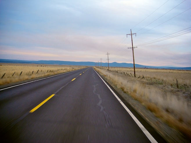
Ten minutes after we left this morning I looked in the mirror and saw flashing lights. Ali asked, “Is that for us?” I think we were both a little surprised, not sure what we’d done. For a moment we thought about making a run for it, sure that our 1600cc engine had what it took, but then remembered the old adage, “You can’t outrun motorola.” The CHiPs had us. Here’s how I remember it going down.
“Good Morning. You folks know why I pulled you over?”
“Was he speeding sir? I told him to slow down back there on that curvy mountainside.”
“Well Miss, I did stop you because of an infraction regarding your speed.”
“I knew it. Why do you have to drive like such a madman?” Ali scolded.
“Actually Miss, he was driving too slow. In fact I clocked your bus at 43 back there in a 55. Here in California we’ve got an unwritten rule to stop any car going more than 5 miles under the speed limit.”
“But isn’t the speed limit supposed to be the absolute maximum limit allowed?” I asked.
“Well, umm, yes sir, so if you could keep it between 50 and 55 that would be good. If not, then maybe you could pull over a bit more often and let the cars pass. I’m not going to give you a ticket or anything, so you folks have a nice day now.”
It was true, we actually were going 43. It was a beautiful day, the sun was just coming up over the mountain tops, and we were on a two lane road winding steeply down the side of one of those mountains. Now, granted, I could have pulled off the road into the dirt once we hit the bottom and the road straightened out, but by then it was a passing lane and I figured the cars could just go around if they were in such a hurry. After all, we were going 50 once we hit the straight away. But hey, what are we gonna do, the world is racing on without us. Everybody has got important business to get to and we’re just out here driving around enjoying the scenery, without so much as a cell phone to distract us from our task. So we spent the rest of the day driving 35 mph and pulling over what felt like every half mile or so. And yes, we did see some amazing sights along the way.
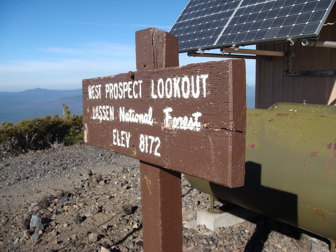
At one point today I noticed a little dirt side road with a sign saying it was twelve miles to Prospector’s Lookout. We liked the sound of that and made the turn off. About two miles in we realized this was probably more often used by ATVs than it was by cars, but it wasn’t too washed out, and was pretty smooth most of the time, so we soldiered on. It took us a good hour to wind our way to the top, switchback after switchback. The mountain appeared to be a perfect cone, because after slowly circling our way to the top we came out onto a tiny plateau about 100 feet across, with an observation shack crowning the peak, and absolutely nothing else impeding our views of the Sierra Nevadas stretching out before us. It was windy and bitterly cold though, and we only lasted about five minutes up there before jumping back in the bus for the hour long drive back down. We didn’t see another person the entire time and were pretty happy with ourselves for finding that little hidden gem of a track.
Later on we were pleased to find that the Lassen Volcanic National Park was still open. Crater Lake closed today, just one day after we visited, and it seemed that most mountain parks were shutting down for the season. Upon entering the park we realized that we had this place to ourselves also. There was nobody anywhere. The road curved around and around, climbing and falling again time after time. There were peaks everywhere, but the main one was the 10,000 foot volcano that blew up back in 1915, causing all sorts of beautiful, varying landscape across the area. The road continued up the volcano until about 8000 feet where there was an empty parking lot and a path with a sign saying it was just a five hour climb to the top of the mountain 2000 feet above us. As fun as that sounded we gave it a miss and continued on. After all, our ultimate destination for the day was Chico, home to the brewers of Sierra Nevada Pale Ale, one of the finest brews ever to wash down a cheeseburger.
The Sierra Nevada Brewery was a bit of a disappointment considering how great the beer is. The bar was small and sort of generic. It seemed they were focusing on making expensive food instead of catering to their beer lovers. However you couldn’t complain about the price of a pitcher. You could also take a self guided tour of the brewery itself, which amounted to reading three plaques perched in front of giant copper vats, and admiring a smallish display of old beer bottles from long lost companies. But again, at the end of it, you couldn’t complain about the price of a pitcher. And with a Taco Bell and a motel right down the street we had the makings of a very nice night.
The bus handled our adventures pretty well today, but we did find that we had one tire that had gone nearly completely flat. We filled it up again, and it seems to be holding air, but more than likely we’ve got ourselves a slow leak.
november 10 2007 : petaluma, california, usa
Today has been a bit of a bust. It started to rain two minutes after we got on the road, and as I sit here in the back of the bus eight hours later it continues. We’re now safely ensconced in a campground just north of San Francisco, after a harrowing drive through the Napa Valley. With the rain today visibility dropped to about a hundred yards, making the beautiful grape vine covered valleys all but disappear before our very eyes. Meanwhile it took all of my concentration just to keep the van under control on the narrow twisting roads that seemed to climb straight up and drop straight back down again all day long. Making it doubly hard was the fact that even on a miserable day like today the two lane roads looked more like the 101 at rush hour. We couldn’t believe the number of people on the roads. Obviously Napa is a huge draw for the wine tourist, but we couldn’t wait to get through it.
november 11 2007 : san francisco, california, usa
In the rain last night I could hear a hissing. There was no more doubt that we had a leaky tire. And by the time we woke up this morning it was pretty well flat. The campground we were at had an air compressor, so we topped it back off and drove down to the gas station where I bought some of that fix-a-flat stuff. It worked like a charm, so now we can procrastinate at least until we just happen to stumble upon a tire repair shop.
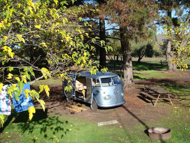
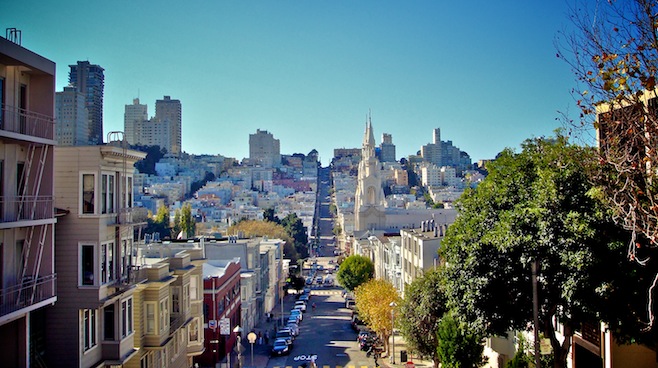
It was just a short drive down the road to San Francisco. We crossed the Golden Gate Bridge, which for some reason I always find to be pretty exciting, and made our way down to the waterfront. The skies had cleared completely overnight and the crowds were out to enjoy it. We found a parking spot on one of those ridiculously steep SF streets that required me to floor the van in reverse to get us to move back up and into our spot. I pulled the hand brake and then watched as we rolled steadily forward. Clearly that alone was not going to hold us (not to mention it pointed out to me that I’ve got some handbrake adjusting to do) so we rolled her against the curb, turned the wheels, put her in reverse, and set the brake. Aside from that all we could do was pray that she was still in the street when we returned and not up on the sidewalk nose first into an old Victorian home.
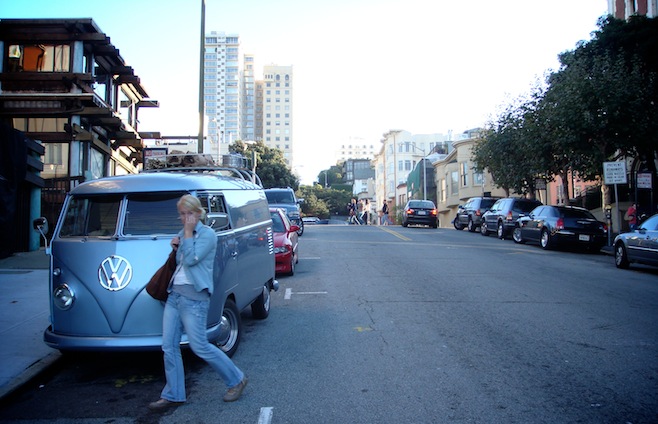
Our original plan was to hit Alcatraz before wandering the city, but when we got there we found the trips were sold out for the day and it’d have to wait for tomorrow. So instead we just started walking. First stop was at Pier 39 to watch the sea lions for a while. Long ago they took over the boat docks there, which is probably when somebody decided to build Pier 39, a long tacky assortment of bad restaurants and t-shirt shops. Every major city has one, and this is San Francisco’s. After that we had to go see Lombard Street, the world’s most crooked street I believe. Everyone has seen this street before. It switchbacks about 8 times in the space of one block, and cars are lined up one after another all day long to drive it. The surprising thing is that it isn’t just a tourist street. It’s actually lined with homes and even has driveways coming right out onto it. We’d love to live there just so we could sit in our window all day watching the tourists go by.
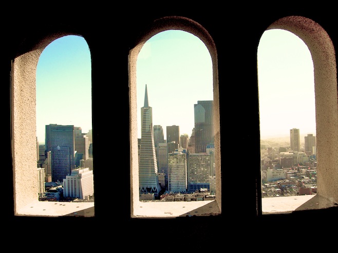
We continued our touristy romp of the city with a visit to the Coit Tower. A smallish tower perched on a high hill with 360 degree views of the city and the bay. By the time we finished with that we were spent. Walking San Francisco is exhausting work. Fortunately there is no shortage of places to grab a drink and sit for a while. Pair that with a burger at In ‘n’ Out and we were all set.
For a place to spend the night we had to drive a few miles south of downtown to an RV park perched on a cliff over the Pacific. When we pulled in and asked about a spot the ladies took a look at our bus, then looked us up and down before deciding that we could spend one night. Apparently with housing prices what they are here, they’ve had to turn away more than a few people who thought that the park would make a nice permanent home for their pop up camper.
So tonight we are the smallest vehicle by roughly 30 feet, and no doubt the least expensive as well. As soon as we got settled we had somebody walk by and ask, “Are you Pat and Ali?” If we had a quarter for every time we’ve been asked that we’d have fifty cents by now. Turned out to be a Bum follower who splits his time between the boat in Mexico and the camper in SF. Tomorrow we’re back in the city for more wholesome touristy fun, cable cars and prisons.
november 13 2007 : buck meadows, california, usa
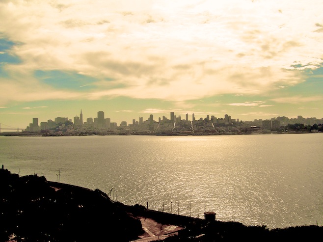
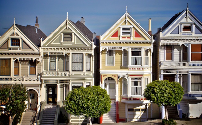
Alcatraz was the first thing on our itinerary the next day. It was about a ten minute ferry ride out there, which gave us great views of the city back behind us. When we landed on the rock 250 people went right, while Ali and I broke left. We wandered through the prison, climbed in the cells, and did some push-ups in the yard. Ali made a shank out of a toothbrush, stabbed a guard, and made a run for the boat back to shore. She made it before anybody knew what had happened and we were soon back in the streets of San Francisco. After a bowl of clam chowder, we drove through town to see the Painted Ladies, a row of perfectly restored Victorian homes across the street from a park with great views of the city scattered out below.
In the afternoon we met up with some new Bum friends who lived downtown in the Mission District. The Mission is a funky, hip neighborhood with tons of restaurant and all sorts of different people. We knew we liked the place when our friends tipped their local homeless crackhead five bucks to come and get us at the bar if the parking police came by and chalked our tires. Much beer and pizza followed, and this morning we came out to the bus to find our windshield ticket free.
This morning we made our way east towards Yosemite National Park. Along the way we came across a big tire repair shop and stopped in to have our flat fixed. A half an hour later the screw that had caused it had been removed and the tire repaired. And best of all, it cost us nothing. Seems that all of the major tire shops in the States will fix your tire for free, apparently in the hope that next time you need tires you’ll remember the favor they did for you. Works for us.
One funny thing that happened with the tire was when the kid fixing it brought the bus down off the jack. His eyes went wide as he looked at the tires. These VWs have this weird suspension system in which the tires camber inwards when there is no load on them, and then even out as the weight is put on. Fully loaded our bus tires sit perfectly flat, but when it is first dropped off a jack the tires point inwards. He was looking at the tires and said, “Did I do that?” He was clearly relieved when I put it in neutral and we rolled it backwards a few feet, evening out the tires again. When we got close to Yosemite we decided to call it a day and head in to the park tomorrow. Instead we got a little more work done. We teamed up to wash the bus, then Ali started in on the laundry, and I fixed a few things around the van.
Over the last couple days I had been having trouble shifting into reverse. When I did, the bus would grind the gears. It seemed like the clutch just wasn’t getting pressed all the way in. Once again though I realized just how simple these buses are to work on. I crawled underneath, located the clutch cable, spun the wingnut half a dozen times to tighten it up, and I was done. While I was under there I also tightened up the hand brake, which didn’t want to stop the bus from rolling down the hill the other day. So far I’m pretty happy with our choice of a simple old VW for this trip.
november 15 2007 : sequoia national park, california, usa
Lately our timing just seems to be off. The other day when we were heading to Yosemite we passed right through a nice little town full of B&B’s and half a dozen restaurants. It still seemed a little early to eat though, so we pressed on to the next town twenty miles or so farther along and right at the edge of the park. Turns out this town had one restaurant, closed for the season, and one gas station. Not interested in backtracking 40 miles round trip for a pizza, we instead settled on microwave burritos and a bag of chips for lunner.
The next day we enjoyed a great drive through Yosemite. El Capitan and Half Dome were the big draws there. Huge chunks of granite rising straight up out of the earth. We made a short hike to the base of El Capitan, the mecca of rock climbing, and just stared up at it for a while. It’s just a slab of rock, but standing there right underneath it, it seems like something more. It made me want to climb it. I wrote that down on my mental chalkboard for later.
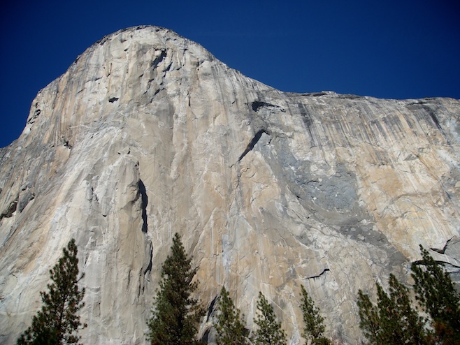
For truly spectacular views of the valley we drove up to Glacier Point. Up there we stood over 7000 feet off of the valley floor. You could hang out over the metal railing and look straight down underneath you to the bottom, while stretching out before us were half a dozen 10,000 foot plus mountains, and straight across the valley floor was Half Dome.
The day sort of slipped away from us and by the time we wound our way back down the road dark was creeping up on us. We made it to Wawona, where we found a campground, and no restaurant. Dinner at the gas station again. We hadn’t eaten all day so we sprung for the plastic wrapped turkey sandwiches this time. We set up our dinner table in the campground and then proceeded to eat our meal with five deer feeding just fifty feet away from us.
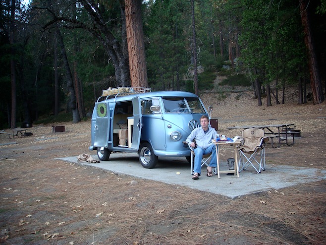
The night was horrendously cold and we were both up at first light eager to move. I hadn’t spent a lot of time looking at the map but figured the drive to Sequoia N.P. couldn’t be more than an hour or two. Turns out I underestimated that one a bit. Trying to stay off anything resembling a main road we instead found ourselves wandering aimlessly through the countryside. We stopped and asked for directions at one point and the guy pointed up the road and told me, “Just head up there to the stop sign and take a left.” As if the sign was just out of sight over the hill. Nine miles later we finally came across a stop sign.
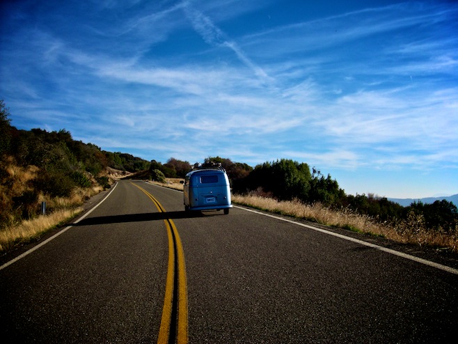
An hour or so before dark we rolled in to Sequoia National Park, home of some mighty big trees. As coincidence would have it, they’re Sequoia trees. We half-heartedly inquired about a campground, with one eye on the freezing overnight forecast written on the bulletin board, but were quickly convinced that the late season special at the hotel was well worth it.
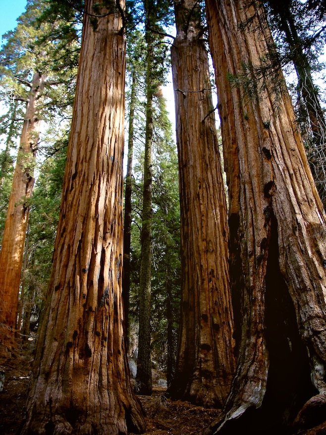
Before settling in for the night we zipped down the road to see General Grant, the world’s third largest tree. Like with the massive granite the day before, the giant sequoias towering above, left us in awe. You can’t truly appreciate the size of these trees without standing alongside of them. Forty feet across, a football field tall, and a couple of thousand years old. Sequoias are virtually fireproof, resistant to bugs, bacteria, and just about anything that can decompose them. So even when one does fall down it lays there virtually unchanged for centuries. One huge fallen tree in the park has been used in the last 150 years or so as a storage shed, a saloon, a horse barn, and a military outpost. Ali and I finished a quick hike around some of the biggest trees in the park before making our way back just before dark.
november 17 2007 : trona, california, usa
After the third biggest tree in the world it was a no brainer that the next day we’d go see number one. General Sherman was right down the road, and again, it was quite a sight. The size and the age of these trees just amazes you when up close. The woods around the area there is called Giant Forest, and we hiked around for a couple of miles surrounded by dozens of them, some of them blown over probably hundreds of years earlier. When we were hiking back to the car we had a coyote come trotting along the trail right at us. About a hundred feet in front of us he peeled off to the side and started to dig at the ground, eventually finding and eating something while we stood there watching.
Our next stop was to Moro Rock, a granite outcropping that we climbed right to the top, some 7000 feet or so above the valley floor. Great views of the mountains piled one on top of another stretched on forever. From there we began to make our way out of Sequoia N.P. The next ten miles seemed to drop straight down with about a thousand switchbacks along the way. Fortunately, as has been the case in every park, there were no other cars at all. As we came around one corner we had to hit the brakes as a bobcat ran across the road in front of us. He stopped underneath the guardrail and peered back at us before disappearing into the woods. Our park brochure said sightings of these were extremely rare because bobcats are nocturnal. We have no idea what this one was doing out at noon, but it was cool to see.
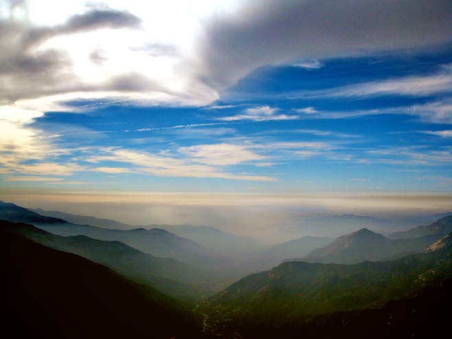
Eventually the road flattened out as we put the Sierras behind us. We were in orange growing, Taco Bell eating country then. We continued on, eventually veering back towards the southern tip of the mountain range. The road became more and more deserted as we wound our way along at a maximum speed of twenty miles an hour, one 180 degree curve after another. Then, just before dark, with no end to the road in sight, a tiny sign pointed off to a campground. We pulled on to the dirt road and found another sign saying it was three miles farther on. We quickly decided that the nice grassy area right where we were would do just fine. It was totally quiet and pitch black within twenty minutes.
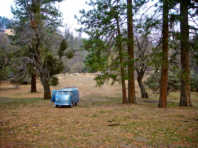
Our original plan had been to head back to the coast after visiting the parks, but after looking at the maps and checking out the weather we decided that a couple of hundred mile detour to Death Valley sounded like a better plan than L.A. and interstates.
There was one more medium sized city along the way there, so we stopped off to get a few last things for the bus that we had thought about over the past couple of weeks. Things like a four way (tire iron) so that I could actually change a tire next time we get a flat, a lighter, a bottle opener, and a flashlight. All those little things that make a VW bus a home. And of course we stocked up on beer and chips before heading out in to the desert. One can never be too safe.
Our moods visibly brightened as the landscape changed from forest to desert. We were thrilled to have finally found warm weather again. Not that the weather has been bad, it has been beautiful actually, but we just can’t deal with cold any more. As midwesterners we are ruined.
Ali absolutely loves the desert landscape and she was pretty well giddy with excitement at the view stretched out before us. There still seemed to be mountains in every direction, but they were brown, red, and pink instead of the rich green of the past few days. Driving alongside one dry lake bed we saw some weird rock formations out in the middle of it. Soon there was a turnoff for these Pinnacles and we took it. It was a seven mile drive over washboard roads and jagged rocks. We passed a handful of jeeps with tires as tall as our bus going the other way. Who needs four by fours when you could have a bus? We parked in the middle of the formations, got out our chairs, cracked a couple of beers, and changed into shorts for the first time in months. It felt great to have beautiful weather and location at the same time again.
We left there around lunner time and made our way for the last town before we actually entered Death Valley. Then the weirdest thing happened. A little white SUV started tailgating us and flashing his lights at us. I said to Ali, “Look at this jerk off. Go around!” We were in a passing zone and I started waving my arm at him to pass. Then he pulled alongside, it was a guy and his kid, and yelled, “Can we talk to you for a minute?”
At this, Ali looked at me and asked, “Do you think he knows us?” I just laughed, thinking that was ridiculous. We were in the middle of nowhere. So we pull over and the guy pops out of his car and says, “I’ve been following you guys forever.” I figured he meant following the bus down the road for miles. Then he says, “A sailing buddy of mine turned me on to Bumfuzzle years ago.” I have to say, if this keeps up we may have to move to California, because we’re starting to get a pretty inflated opinion of ourselves. Actually, it just shows what a small world we live in. Here is this guy taking his son out for a day of hiking around in the desert, and he just happens to pass us right as we pull out from the side road to the Pinnacles where we had been sitting for hours.
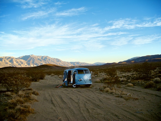
After eating at the only place in town we continued off farther into the desert to find a place to camp for the night. We came over a hill and found a big valley completely hemmed in by mountains, with dirt roads criss crossing all over the valley floor. We drove on a while before picking a road and pointing the bus down one. We probably should have walked it a little bit first, because as soon as I started in I could feel the wheels sinking. I stayed on the gas, knowing momentum was the only way we were going to keep from getting stuck. We bounced along slightly out of control for a couple of hundred yards before finally finding a small area of hard pack where we could stop. The bus had grazed a few rough bushes along the way, giving us our first scrapes to the paint, which Ali was really thrilled with me about. However, as a camp for the night it couldn’t have turned out better. The sky lit up with stars, and there was no sound from anything anywhere.
november 19 2007 : mojave desert, california (12 nights in the bus : 6,109 miles)
Before taking off the next morning I took a walk along our path out and broke off all the overhanging branches so they wouldn’t scratch the other side of the bus on the way out. I then spent about a half an hour planning out just how I was going to get the bus turned around and pointed the other way. The sand was really soft, and there wasn’t much room for error. The planning paid off and I got us facing the right direction with about twenty feet of hard pack in front of us to get moving. We strapped ourselves in and I gunned it. Alright, that’s a little dramatic, but I did keep the gas pegged the entire way out, slipping and bouncing all the way. All I heard from the passenger seat was, “Pat (pause) Pat (pause) Pat (pause) Pat.” And finally, “I didn’t like that.” I thought it was fun and actually pretty hilarious considering what we were driving, and was kicking myself afterwards for not having Ali videotape it.
Down the road we entered Death Valley National Park. The scenery was great and once again we seemed to be the only people on the planet. Right up until we got to Stovepipe Wells, one of only two “towns” in the park. Suddenly there were RVs and people everywhere. We had originally thought about staying in a campground there, but ruled that out as soon as we saw the parking lot/campground. Instead we filled up the tank, ate a quick cheeseburger at the only joint in town, and continued farther in to the park.
We drove up a long road to Ubehebe Crater, a volcano that blew about 200 years ago, with plans to continue on to the Racetrack. The Racetrack is this weird place where rocks move across the sand, leaving trails like a snail would. The road down there was 27 miles long and said it was for high clearance four wheel drives only. After the day before I figured that meant us. So after promising Ali we’d turn around if it got too rough we headed in. The first fifty feet were nice, and then the washboard started. It was bone jarring, but we figured it couldn’t go on like that for very long. But after a mile and a half of it we had to concede that we’d been defeated. We spun around and made our way back to a smaller back country campground for the night.
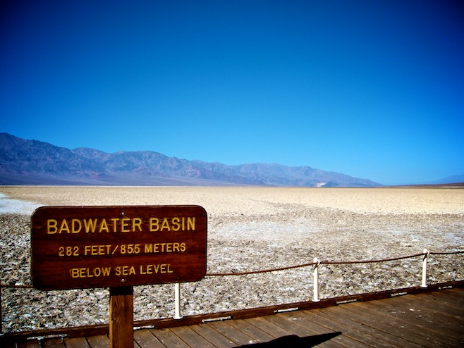
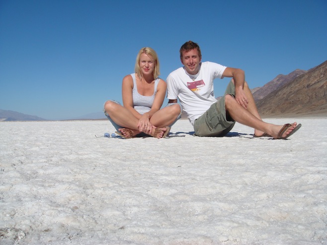
We saw the rest of the tourist sights inside Death Valley today, including of course the lowest point in the United States. Badwater Basin, at 282 feet below sea level, is a sweltering salt flat most of the year, but today, with a temp around 90, it was glorious. In fact, today was the first day that we were actually able to crack the safaris and get a little air conditioning going.
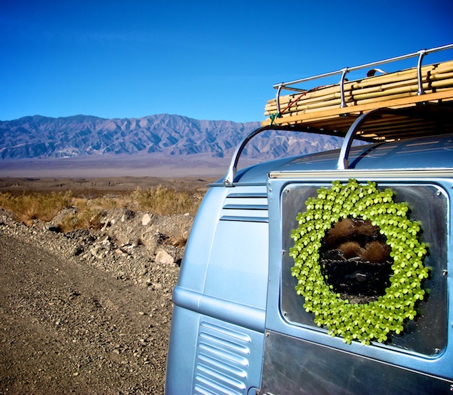
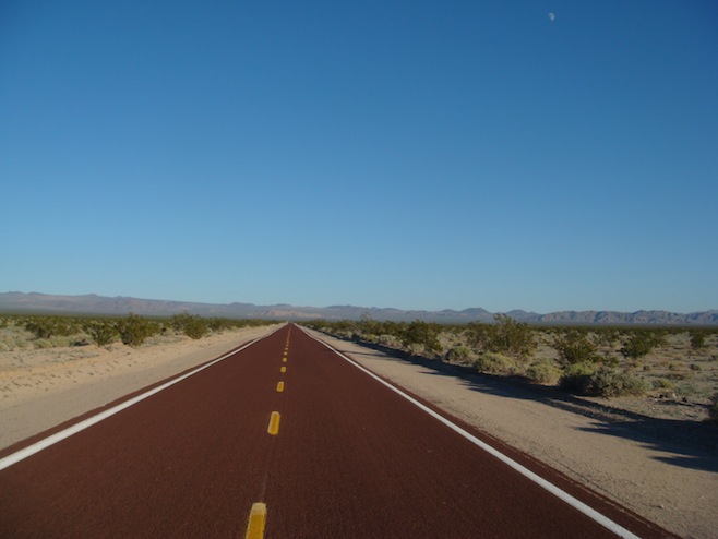
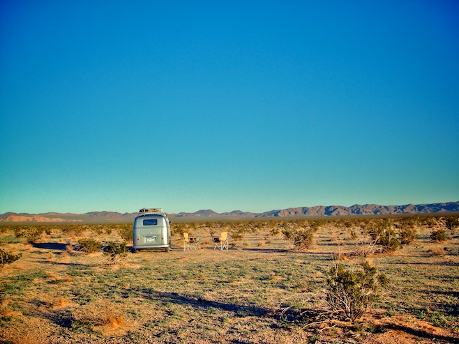
By evening we found ourselves in the Mojave Desert, outside of Baker. We love the desert. We just drive down the road until we find a reasonably solid dirt road heading off to nowhere. We turn off there, drive a mile or two and stop. Set up camp and relax. It’s that simple. We never see anybody. Setting up camp doesn’t really consist of a whole lot other than me throwing down our bamboo mat and pulling out a couple of chairs, and Ali usually wiping down the interior which always seems to get a bit dusty throughout the day. Takes us about two minutes.
november 23 2007 : san felipe, baja california norte, mexico
From the Mojave we continued south for a couple of days, stopping in Joshua Tree National Park for a night. It’s a strange landscape, with the weird Joshua trees, and piles of boulders that look as if a giant took a handful and then set them in piles all over the place. The park was packed though, and knowing that we could have just as easily spent the night for free and in total peace just a few miles away was a little frustrating. In the morning we were up with the sun and back on the road.
We spent our last night on U.S. soil in the uninspiring town of El Centro, just a few miles north of the border. We got a hotel there and used it to fill up our water tank and do laundry.
Early the next day we crossed the border into Mexico, at Mexicali. As we approached the border station we weren’t really sure what we needed to do. We got in line and slowly made our way in, and then, before we knew what had happened we were driving in town. We were through the border without anybody even glancing at us. Normally that might be a good thing, but we needed some paperwork if we were going to spend a few months here and exit the country in Guatemala.
We circled back, found a parking spot, and I ran off to find somebody who might be an official. I made my way to the immigration office which was empty, other than two bored looking employees watching bad television. After a bunch of random, terrible Spanish, I communicated that we needed tourist cards and a vehicle permit. They weren’t doing it though, and told me I needed to go to the new border that was, “Just down this road.”
So Ali and I started driving down the road which ran right through town. After about five miles we stopped and broke out the Lonely Planet map. It showed that the next border was 40 miles away down this road. There was a tourist office not far away though, so we decided to seek help there. The nice lady at that office directed me right back to the Immigration office we’d just left. So now, about an hour after our first visit, I walked back in. Only one lady was left and she seemed a little unhappy to see me again. She explained again that she could not issue us a vehicle permit, but she did break out her little book to give us our tourist cards. After a trip to the bank to pay for those we had one project completed. And upon returning our passports she showed me on a map where this new border crossing was, just 6 miles away. We’d given up just a bit early last time.
Despite her having drawn pictures of the peaked roof tents at the border we still had a bit of trouble finding the place. A good three hours had elapsed since we crossed the border and we were getting pretty frustrated. I mean, come on, this is Mexico. This should be a piece of cake. We finally found the right place and got our vehicle permit without any issues. Then I asked, “Where do we get insurance.” And of course the reply was, “Just down the road, you can’t miss it.”
We of course did miss it. Over and over again. As you know, we are generally very happy being self insured, but this Mexico liability insurance thing appears to be mandatory, so we continued on looking. By the time we found the place, got our insurance papers, and were back on the road, over four hours had elapsed and we still had 120 miles to go to San Felipe, our destination for now.
Driving down the highway it became apparent that San Felipe wasn’t going to be our ideal Mexico. The reason being that 95 out of the 100 cars that passed us along the highway had either California or Arizona plates. We’re obviously going to need to venture farther afield to find those deserted beaches and fish tacos.
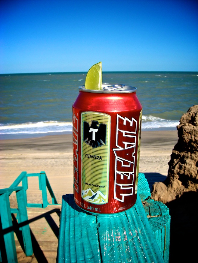
Just before dark we pulled in to a campground, drove the VW underneath a palapa on the beach, and cracked a Tecate. The restaurant wasn’t opening until next week, and we were too exhausted to drive at night to town, so for Thanksgiving dinner we split a bag of pretzels and a six pack. However we did eat that alongside a campfire overlooking the ocean with a full moon above us.
november 25 2007 : san quintin, baja california norte, mexico
After another day in San Felipe, enjoying the sun and gorging on tacos, we headed west towards the Pacific. We encountered our third, fourth, and fifth military checkpoints, which were all over in a flash. A quick peek around the van, a tap here, a tap there, and we’re free to go.
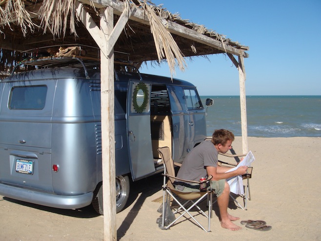
Along the way we decided to make our way up into the mountains and visit the Parque Nacional Constitucion. We stopped off at a tiny restaurant in the equally tiny town of Ojos Negros. Afterwards we were sitting in the van looking at our map when an off-road motorcycle came right at us. It pulled alongside and the next thing we heard was, “Bumfuzzle.” We’ve been on a roll lately meeting people in strange out of the way places. It turned out they were heading for the Parque too. Small world. This park is about twenty miles off road and 6000 feet up, smack dab in the middle of the Baja peninsula.
We made our way out of town along steadily deteriorating dirt roads, though none of it was too trying at first. Then we made a wrong turn. Soon Ali and I were rock crawling along a path just barely wide enough for us. We were going along pretty good until we came around one corner and found a gnarly rock right in the middle of the path. There was no room on either side of it and no way we had the clearance for it, so we had to give up the good fight and make our retreat. Fortunately our friends went on ahead and quickly found our earlier mistake. They caught up to us and got us turned around and pointed in the right direction. It took us a good hour to cover the twenty rough miles up the mountain, but the worst of it was really only some long washboard stretches.
At the top we found Laguna Hanson, which is, as the name would suggest, a lagoon. Or at least it was at one point. We spoke to somebody later that told us they hadn’t gotten much rain lately and the lagoon had dried up nine years earlier. Now it’s just an empty field with big boulders strewn about and pine forests lining the edge.
We all made camp and gathered wood. It took about thirty seconds to gather enough wood to burn for a week, which I only point out because a guy came by later on trying to sell us firewood. This is possibly the only place in Baja that you would not be able to sell firewood, but he was out there trying anyway. He probably tells his buddies that he could sell ice to an eskimo if he wanted.
When Ali went to get in the back of the bus she found that our cargo door handle was jammed. We eventually had to climb in through the back and take the thing apart to get the doors opened. It turned out that the mechanism, which is a sealed unit from 1958, is falling apart on the inside. You can see that the portion that turns is all bent and out of whack. After much banging and fiddling around we somehow got it working again. That’s when Ali climbed in to grab drinks and found that the fridge wasn’t working either. Seems the rough road took a toll on us today.
As the sun went down the temperature plummeted and it became clear real quick that we were in for a brutally frigid night. We all hung out around the fire until the last possible second before racing off to bed. The night actually turned out to be even worse than we imagined, and it now ranks as our coldest night ever spent outdoors. Sleep was miserable as we tried to stay warm. At one point I woke up to find Ali’s feet were in my armpits. No lie. She had herself wrapped up to about the size of a basketball underneath the covers. I’m not nearly as flexible so my feet remained frozen down at the end of the bed. In the morning we even found that our water had frozen up overnight. We nearly froze to death in Mexico. How does that happen?
As the sun came up we said goodbye to our new friends and retraced our route from the day before. Since the trip back was all downhill I probably drove about twice as fast as I should have, which Ali would attest to, and soon we were back on the highway headed for the coast. After the night we had we decided to double our efforts at getting south to the warm weather. We blew through Ensenada and eventually stopped in San Quentin where we found what appears to have been some sort of RV camp in the distant past, and is where we are boondocking it tonight.
Speaking of boondocking, we’ve both been a bit shocked by the amount of email we’ve received warning us against doing just that. It seems like everybody knows somebody who knows somebody who was once accosted in Mexico. In fact, we’ve received more warnings about Mexico and its bandidos than even the Red Sea and Pirate Alley got us. That’s saying something. We’re not sure where this Mexi-phobia comes from exactly, but this isn’t our first time here and we’ve yet to have any sort of negative experience at all. Hopefully that continues and we can report in a few months that all is well down here south of the border.
november 28 2007 : san francisquito, baja california norte, mexico
Bahia de los Angeles was our next destination, a small town back over on the Gulf side of Baja. Along the way we stopped at Mama Espinoza’s for a big breakfast. Since I don’t eat eggs I don’t really care for breakfast, so anytime we stop for breakfast it earns me points, as if I am doing something special for Ali. We both play this game. Anyway Mama Espinoza’s is sort of a famous little place located along the Baja 1000 off-road race course. All the teams stop there and leave their bit of race paraphernalia behind. They had great food, which was a good thing, because little did we know at the time that it would be the last time we ate for the next couple of days.
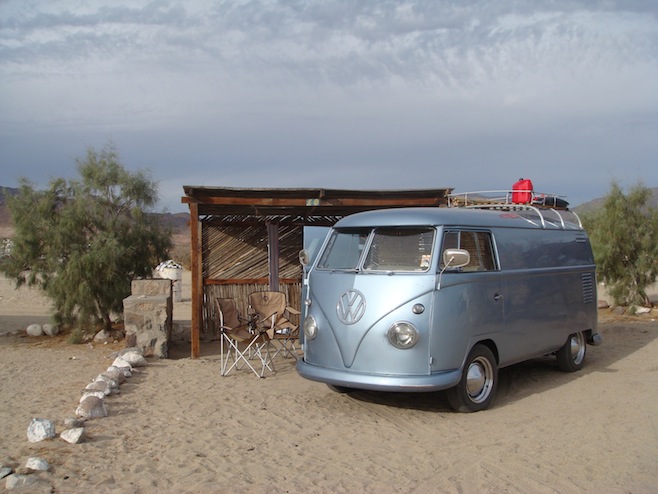
We spent the night at a rundown campground right on the beach in Los Angeles. The setting was beautiful, but the cloudy weather and the flies didn’t do the place any favors. We decided to leave the next morning for points farther south.
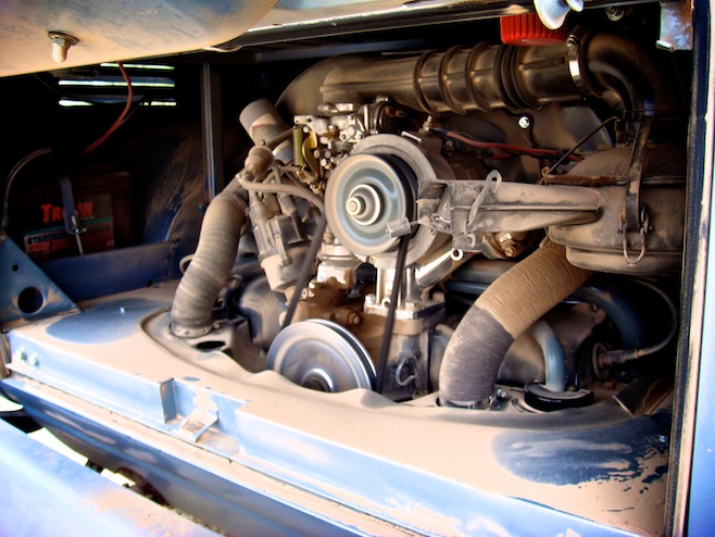
In the morning we got a few chores done before setting out. Ali has had her hands full keeping the dust from turning into dunes in the back of the bus, while I needed to get the oil changed, and more importantly, the air filter. The oil change is simple, but I hadn’t cleaned the air filter before. We have an oil bath air filter on the engine, which basically means that the air comes in through this canister, the particles get trapped in the oil “bath” and the clean air continues on its merry way. Once I took it out and had a look at it I was pretty happy with the system. Inside the canister was piles of muck, dirt that had been trapped and turned to mud. It seems the system is just what we needed in this environment. In a half an hour we were both done, and had a sparkling clean, well oiled machine again. Then we realized the cargo doors were jammed again and I spent another half an hour getting that working again.
Our map showed a dirt road of indeterminate length heading down to San Francisquito, but we had heard that the drive was worth it, so after making a couple inquiries in town to make sure we had the right dirt road, we rolled on.
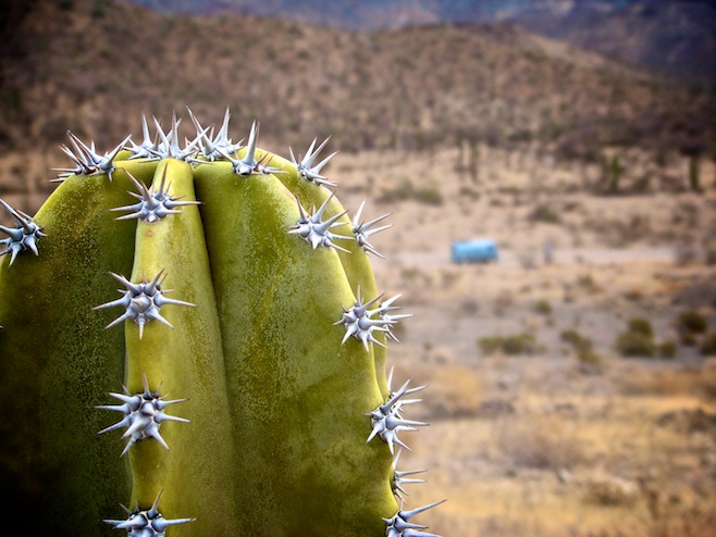
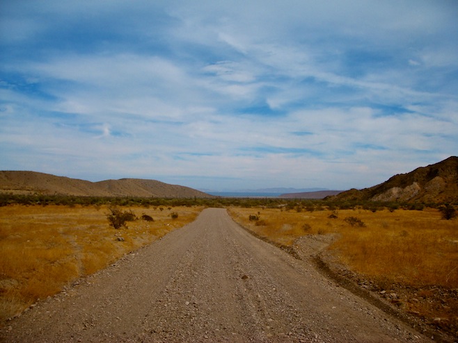
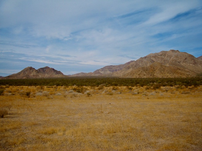
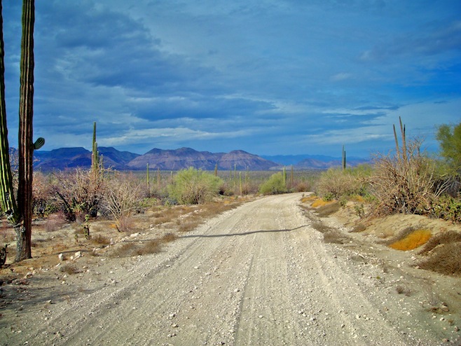
The road was pretty rough, but by keeping our speed down around fifteen miles an hour we were able to have a fairly comfortable drive. The best part was that there were no washboards, just a lot of nasty rock/boulders to steer around and over. We enjoyed the drive for the first few hours, passing through valleys of cactus and sand dunes, but started to get a little concerned after about fifty miles. We had only had one car pass us during our first four hours on the road and since then we’d passed a couple of turn-offs that seemed like they held a little bit of promise, but had no signs. As we continued on the road started to deteriorate a bit as it climbed through the mountains. The boulders became a bit larger, and the washed out sections became a bit deeper. The wash outs were tricky because we had to straddle them just right, and they were always around corners. Some of these wash outs were so big a midget could have walked underneath the bus without ducking.
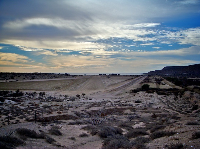
At mile 75, just about the time we thought for sure we had missed the turn-off we saw a sign for a welder in San Francisquito. It was another 15 miles of rough going before we finally made it to the water, and when we did we weren’t entirely sure we were at the right place. We’ve always sort of associated a town name on a map with an actual town. Here we found instead two small shacks in one bay, two more incredibly run down shacks on another beach, and one very nice empty house sitting up on the hill above it all. The strange thing was that there was a dirt landing strip just behind the beach, and it was perfectly groomed. It’s hard to imagine just what the purpose of that might be, though if you were the type to think such thoughts you could easily imagine this as a fueling point for drug running planes. We just stick with the old army policy of don’t ask don’t tell and nobody seems to bother with us.
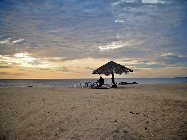
Once we satisfied ourselves that there was no Roberto’s Taco Stand hiding behind any cactus we scouted out a spot on the beach with hard sand and parked. After gathering up some driftwood we grabbed our bag of chips, granola bar, and beer (miraculously the fridge is working just fine again), and got a nice fire going. The beach was amazing, with spotless soft white sand, and secluded. And while we sat there we even got to watch as a pod of dolphins came in and fed just fifty yards offshore.
This morning we woke to a view out our window of a gently sloping beach leading down to calm water with an orange sky lighting everything up. There is nobody around, Ali’s drinking coffee at a table on the beach, I’m busy typing this and, being the grown-up that I am, drinking cherry Kool-Aid. It’d be perfect if the clouds hadn’t rolled in again, but it’s still pretty close.
november 31 2007 : santa rosalía, baja california sur, mexico
From San Francisquito there were two choices. We could go back the way we came, or try and find a road shown on the map heading west. The problem with finding the new road, was that there were three equally large turn-off roads within a couple of miles of each other, only one with a town name, and that didn’t show on our map at all. The other problem was that if we drove fifty miles farther and then got turned around by a dead end or rough roads we’d run out of gas. So in the end we made the tough decision to retreat over 90 miles of rough, but familiar road.
Upon arriving back in Los Angeles we made our way to the taco stand. We weren’t overly hungry at that point, but the smell of the food changed that quickly. Unfortunately somebody had placed a huge takeaway order before us which took the old lady thirty minutes to make on her tiny stove. When our tacos finally came out we scarffed them down like rabid dogs in under a minute.
Then next morning we found an internet cafe’ and updated the website. While we were there the power to the whole town went out. We didn’t think much of that until we hit the gas station on our way out and found the pumps not working. I did some quick calculations and determined that we just might make it to our destination on what we had, but if not we would have enough with our spare gas tank. Turns out my calculation was dead on. Five miles before the town with gas we started to sputter. We coasted along the highway looking for a place to roll off to the side, but by the time we finally rolled to a stop we hadn’t found one spot in which the road didn’t abruptly end and drop off sharply into a ditch.
So there we sat, in the middle of the southbound lane on the Transpeninsular Highway trying to quickly add gas to our tank while semi-trucks passed without so much as a tap on the brakes. The whole bus shook as they roared by, and Ali quickly found a spot down in the ditch twenty yards away from which to yell helpful instructions like, “Pat, Pat, hurry…oh my God…hurry…Pat…oh my God…what’s taking you so long?”
It was five minutes of fun. And of course, five minutes after that we were at a gas station. Where, I might add, the attendants seem to have an uncanny knack for overfilling my tank. At every fill up we get to enjoy the sight of gas pouring down the side of the bus and dripping out from the crevices of the engine compartment. Meanwhile the attendants act as if nothing at all has happened. We really need some sort of non-overfilling gas cap on this thing, because that gaping hole in the end of our cap is not doing us any favors.
A bit farther on down the road we came to an Agricultural Inspection. Essentially it seems to be a toll. For ten pesos, about a buck, we got to drive over a hose with a couple of pin prick size holes in it. This hose was shooting up a feeble spray of some mixture containing roughly 99% water that covered about 1% of our bus as we drove over it. With that problem solved we then had to pop in to the office to show them that we did indeed have our tourist cards. It all took about two minutes and we were back underway.
The weather was pretty crappy so we stopped for the night in Guererro Negro. The town wasn’t much to look at, we chose probably the worst restaurant there, and we spent the night parked in a concrete walled lot with a half dozen RVers who were traveling in a flock.
We woke up the next day to rain, but knew that Guererro Negro was no place to spend the day, so we drove on anyway. We crossed the Vizcaíno Desert in a driving rain, which, judging by all the signs telling us not to waste the deserts most precious commodity, water, was not supposed to happen. By the time we reached Santa Rosalía on the Sea of Cortez the roads were flooding. We drove aimlessly through town a couple of times before setting our sights on a hotel for the night.
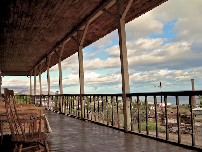
We found a great place perched on the hill above town. It’s been here since 1886 when it was built to house the girls from the brothel down the street. Outside our door is a huge balcony that runs the length of the building and totally reminds me of those scenes from the Clint Eastwood movie where the girls would be sitting on the balcony railing flashing those seductive looks at Clint as he rode into town chewing on a stogie and looking mean. It’s a good way to spend a rainy day and get out of the bus for a few hours.

.jpg)
.jpg)
.jpg)
.jpg)
.jpg)
.jpg)
.jpg)
.jpg)
.jpg)
.jpg)
.jpg)
.jpg)
.jpg)
.jpg)
.jpg)
.jpg)
.jpg)
.jpg)
.jpg)
.jpg)
.jpg)
.jpg)
.jpg)
.jpg)
.jpg)
2 Comments on “November 2007”
A great blog with INCREDIBLE photos! I don’t know how much time I spent on it. Now I want to sell my home in Arizona and go on a similar journey =)
Thanks! Go for it, you won’t regret it.